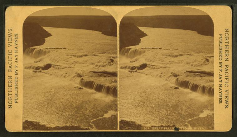
Great Falls, Missouri River.
Publisher: Haynes, Frank Jay
Photographer: Haynes, F. Jay (Frank Jay) (1853-1921)
Collection: NYPL Digital Collections: Robert N. Dennis [From The New York Public Library]
Photographer: Haynes, F. Jay (Frank Jay) (1853-1921)
Collection: NYPL Digital Collections: Robert N. Dennis [From The New York Public Library]
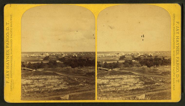
Jamestown and valley.
Publisher: Haynes, Frank Jay
Photographer: Haynes, F. Jay (Frank Jay) (1853-1921)
Collection: NYPL Digital Collections: Robert N. Dennis [From The New York Public Library]
Photographer: Haynes, F. Jay (Frank Jay) (1853-1921)
Collection: NYPL Digital Collections: Robert N. Dennis [From The New York Public Library]
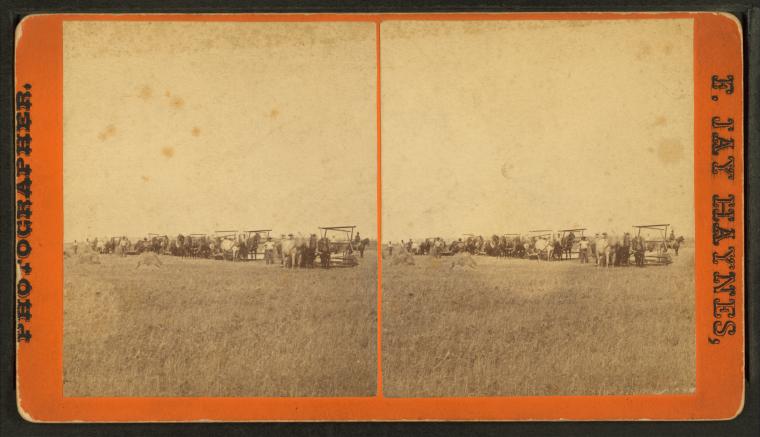
Men with teams of horses harvesting a field.
Publisher: Haynes, Frank Jay
Photographer: Haynes, F. Jay (Frank Jay) (1853-1921)
Collection: NYPL Digital Collections: Robert N. Dennis [From The New York Public Library]
Photographer: Haynes, F. Jay (Frank Jay) (1853-1921)
Collection: NYPL Digital Collections: Robert N. Dennis [From The New York Public Library]
Men with teams of horse plows seeding a field.
Publisher: Haynes, Frank Jay
Photographer: Haynes, F. Jay (Frank Jay) (1853-1921)
Collection: NYPL Digital Collections: Robert N. Dennis [From The New York Public Library]
Photographer: Haynes, F. Jay (Frank Jay) (1853-1921)
Collection: NYPL Digital Collections: Robert N. Dennis [From The New York Public Library]
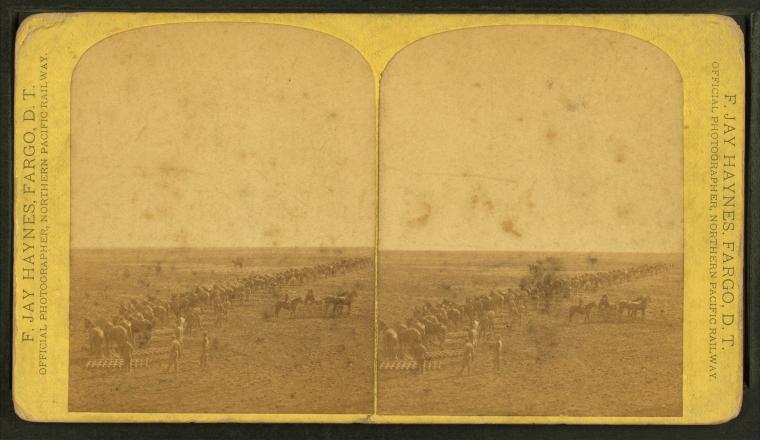
The Spiritwood Farms. [Row of horse plows lined up for work.]
Publisher: Haynes, Frank Jay
Photographer: Haynes, F. Jay (Frank Jay) (1853-1921)
Collection: NYPL Digital Collections: Robert N. Dennis [From The New York Public Library]
Photographer: Haynes, F. Jay (Frank Jay) (1853-1921)
Collection: NYPL Digital Collections: Robert N. Dennis [From The New York Public Library]
Seeding. [Men with teams of horse plows seeding a field.]
Publisher: Haynes, Frank Jay
Photographer: Haynes, F. Jay (Frank Jay) (1853-1921)
Collection: NYPL Digital Collections: Robert N. Dennis [From The New York Public Library]
Photographer: Haynes, F. Jay (Frank Jay) (1853-1921)
Collection: NYPL Digital Collections: Robert N. Dennis [From The New York Public Library]
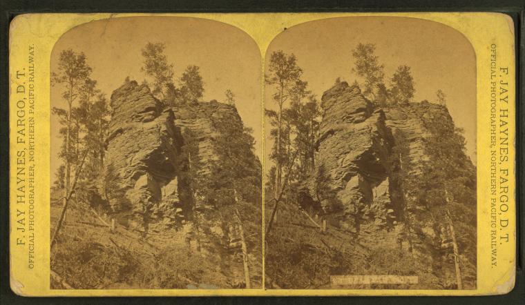
Palisades, near Deadwood.
Publisher: Haynes, Frank Jay
Photographer: Haynes, F. Jay (Frank Jay) (1853-1921)
Collection: NYPL Digital Collections: Robert N. Dennis [From The New York Public Library]
Photographer: Haynes, F. Jay (Frank Jay) (1853-1921)
Collection: NYPL Digital Collections: Robert N. Dennis [From The New York Public Library]
Bear Paw Cliff.
Publisher: Haynes, Frank Jay
Photographer: Haynes, F. Jay (Frank Jay) (1853-1921)
Collection: NYPL Digital Collections: Robert N. Dennis [From The New York Public Library]
Photographer: Haynes, F. Jay (Frank Jay) (1853-1921)
Collection: NYPL Digital Collections: Robert N. Dennis [From The New York Public Library]
Train ploughing through deep snow.
Publisher: Haynes, Frank Jay
Photographer: Haynes, F. Jay (Frank Jay) (1853-1921)
Collection: NYPL Digital Collections: Robert N. Dennis [From The New York Public Library]
Photographer: Haynes, F. Jay (Frank Jay) (1853-1921)
Collection: NYPL Digital Collections: Robert N. Dennis [From The New York Public Library]
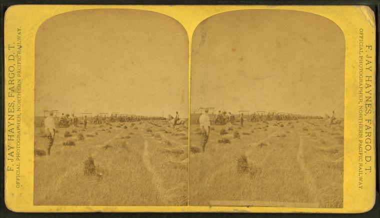
Harvesting, Williams Farm, D.T.
Publisher: Haynes, Frank Jay
Photographer: Haynes, F. Jay (Frank Jay) (1853-1921)
Collection: NYPL Digital Collections: Robert N. Dennis [From The New York Public Library]
Photographer: Haynes, F. Jay (Frank Jay) (1853-1921)
Collection: NYPL Digital Collections: Robert N. Dennis [From The New York Public Library]
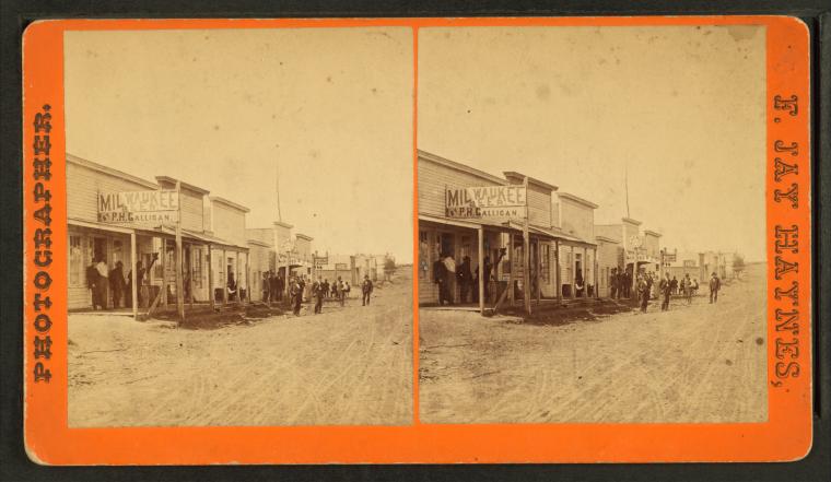
4th Street, Bismarck, D.T.
Publisher: Haynes, Frank Jay
Photographer: Haynes, F. Jay (Frank Jay) (1853-1921)
Collection: NYPL Digital Collections: Robert N. Dennis [From The New York Public Library]
Photographer: Haynes, F. Jay (Frank Jay) (1853-1921)
Collection: NYPL Digital Collections: Robert N. Dennis [From The New York Public Library]
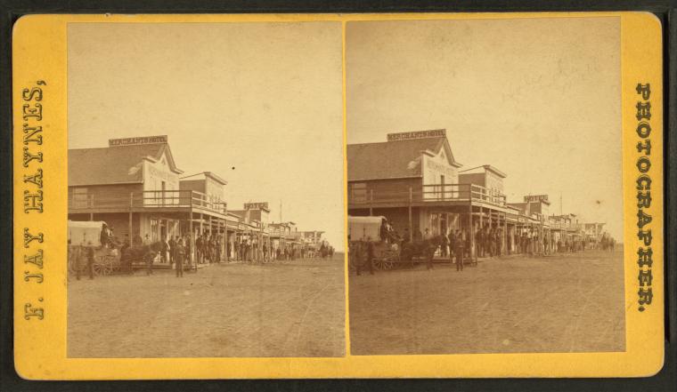
E. on Main Street, Bismarck, D.T.
Publisher: Haynes, Frank Jay
Photographer: Haynes, F. Jay (Frank Jay) (1853-1921)
Collection: NYPL Digital Collections: Robert N. Dennis [From The New York Public Library]
Photographer: Haynes, F. Jay (Frank Jay) (1853-1921)
Collection: NYPL Digital Collections: Robert N. Dennis [From The New York Public Library]
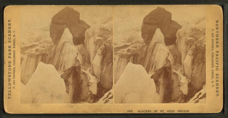
Glaciers of Mt. Hood Oregon.
Publisher: Haynes, Frank Jay
Photographer: Haynes, F. Jay (Frank Jay) (1853-1921)
Collection: NYPL Digital Collections: Robert N. Dennis [From The New York Public Library]
Photographer: Haynes, F. Jay (Frank Jay) (1853-1921)
Collection: NYPL Digital Collections: Robert N. Dennis [From The New York Public Library]
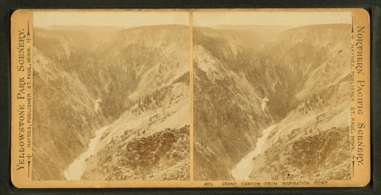
Grand Canyon from Inspiration Point.
Publisher: Haynes, Frank Jay
Photographer: Haynes, F. Jay (Frank Jay) (1853-1921)
Collection: NYPL Digital Collections: Robert N. Dennis [From The New York Public Library]
Photographer: Haynes, F. Jay (Frank Jay) (1853-1921)
Collection: NYPL Digital Collections: Robert N. Dennis [From The New York Public Library]
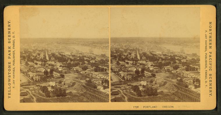
Portland Oregon.
Publisher: Haynes, Frank Jay
Photographer: Haynes, F. Jay (Frank Jay) (1853-1921)
Collection: NYPL Digital Collections: Robert N. Dennis [From The New York Public Library]
Photographer: Haynes, F. Jay (Frank Jay) (1853-1921)
Collection: NYPL Digital Collections: Robert N. Dennis [From The New York Public Library]
Petrified stump, [...] diameter.
Publisher: Haynes, Frank Jay
Photographer: Haynes, F. Jay (Frank Jay) (1853-1921)
Collection: NYPL Digital Collections: Robert N. Dennis [From The New York Public Library]
Photographer: Haynes, F. Jay (Frank Jay) (1853-1921)
Collection: NYPL Digital Collections: Robert N. Dennis [From The New York Public Library]
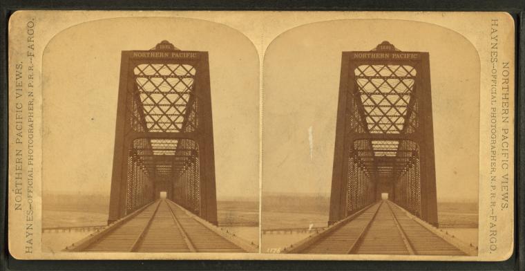
Northern Pacific Railway bridge.
Publisher: Haynes, Frank Jay
Photographer: Haynes, F. Jay (Frank Jay) (1853-1921)
Collection: NYPL Digital Collections: Robert N. Dennis [From The New York Public Library]
Photographer: Haynes, F. Jay (Frank Jay) (1853-1921)
Collection: NYPL Digital Collections: Robert N. Dennis [From The New York Public Library]
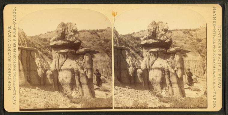
Pillars capped with petrifications, BadLands.
Publisher: Haynes, Frank Jay
Photographer: Haynes, F. Jay (Frank Jay) (1853-1921)
Collection: NYPL Digital Collections: Robert N. Dennis [From The New York Public Library]
Photographer: Haynes, F. Jay (Frank Jay) (1853-1921)
Collection: NYPL Digital Collections: Robert N. Dennis [From The New York Public Library]
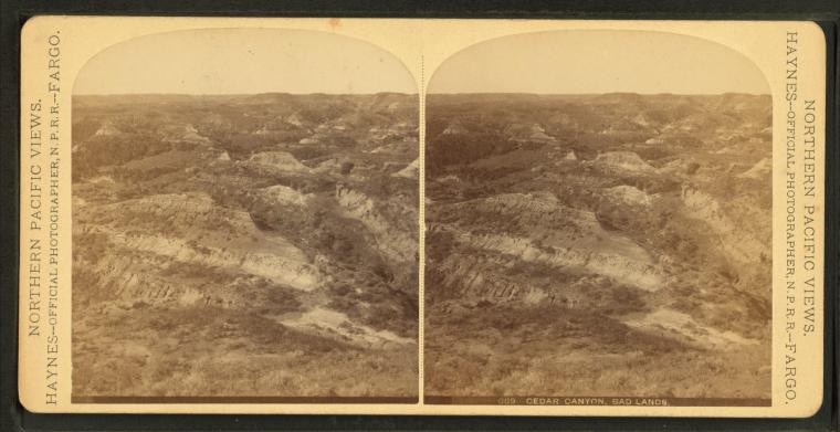
Cedar Canyon, BadLands.
Publisher: Haynes, Frank Jay
Photographer: Haynes, F. Jay (Frank Jay) (1853-1921)
Collection: NYPL Digital Collections: Robert N. Dennis [From The New York Public Library]
Photographer: Haynes, F. Jay (Frank Jay) (1853-1921)
Collection: NYPL Digital Collections: Robert N. Dennis [From The New York Public Library]
Traders store Ft. Berthold. [Native and Euro-Americans at the trading post at Fort Berthold Agency.]
Publisher: Haynes, Frank Jay
Photographer: Haynes, F. Jay (Frank Jay) (1853-1921)
Collection: NYPL Digital Collections: Robert N. Dennis [From The New York Public Library]
Photographer: Haynes, F. Jay (Frank Jay) (1853-1921)
Collection: NYPL Digital Collections: Robert N. Dennis [From The New York Public Library]
Cascade Falls from below [...].
Publisher: Haynes, Frank Jay
Photographer: Haynes, F. Jay (Frank Jay) (1853-1921)
Collection: NYPL Digital Collections: Robert N. Dennis [From The New York Public Library]
Photographer: Haynes, F. Jay (Frank Jay) (1853-1921)
Collection: NYPL Digital Collections: Robert N. Dennis [From The New York Public Library]
Maiden of the BadLands [rock formation].
Publisher: Haynes, Frank Jay
Photographer: Haynes, F. Jay (Frank Jay) (1853-1921)
Collection: NYPL Digital Collections: Robert N. Dennis [From The New York Public Library]
Photographer: Haynes, F. Jay (Frank Jay) (1853-1921)
Collection: NYPL Digital Collections: Robert N. Dennis [From The New York Public Library]
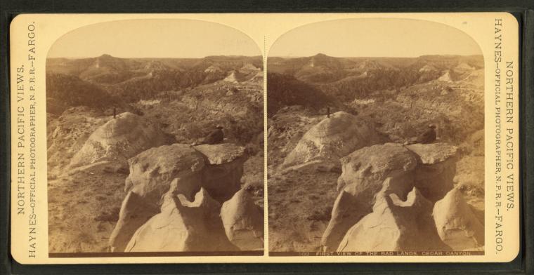
First view of the BadLands, Cedar Canyon.
Publisher: Haynes, Frank Jay
Photographer: Haynes, F. Jay (Frank Jay) (1853-1921)
Collection: NYPL Digital Collections: Robert N. Dennis [From The New York Public Library]
Photographer: Haynes, F. Jay (Frank Jay) (1853-1921)
Collection: NYPL Digital Collections: Robert N. Dennis [From The New York Public Library]
Buffalo hunting, Yellowstone River. [Hunter posing with fallen bison.]
Publisher: Haynes, Frank Jay
Photographer: Haynes, F. Jay (Frank Jay) (1853-1921)
Collection: NYPL Digital Collections: Robert N. Dennis [From The New York Public Library]
Photographer: Haynes, F. Jay (Frank Jay) (1853-1921)
Collection: NYPL Digital Collections: Robert N. Dennis [From The New York Public Library]
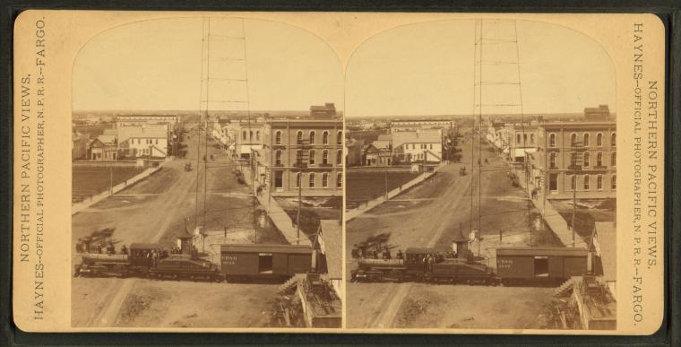
Train crossing through town.
Publisher: Haynes, Frank Jay
Photographer: Haynes, F. Jay (Frank Jay) (1853-1921)
Collection: NYPL Digital Collections: Robert N. Dennis [From The New York Public Library]
Photographer: Haynes, F. Jay (Frank Jay) (1853-1921)
Collection: NYPL Digital Collections: Robert N. Dennis [From The New York Public Library]
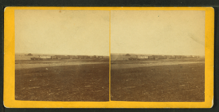
Construction train, west of Hays City, Kansas.
Publisher: Gardner's Photographic Art Gallery
Photographer: Gardner, Alexander (1821-1882)
Subjects: Railroads construction & maintenance, Railroads, Railroad cars, Kansas, Plains
Collection: NYPL Digital Collections: Robert N. Dennis [From The New York Public Library]
Photographer: Gardner, Alexander (1821-1882)
Subjects: Railroads construction & maintenance, Railroads, Railroad cars, Kansas, Plains
Collection: NYPL Digital Collections: Robert N. Dennis [From The New York Public Library]
View on the Plains, Kansas, 6 miles west of Fort Hays, 586 miles west of St. Louis, Mo.
Publisher: Gardner's Photographic Art Gallery
Photographer: Gardner, Alexander (1821-1882)
Subjects: Kansas, Plains
Collection: NYPL Digital Collections: Robert N. Dennis [From The New York Public Library]
Photographer: Gardner, Alexander (1821-1882)
Subjects: Kansas, Plains
Collection: NYPL Digital Collections: Robert N. Dennis [From The New York Public Library]
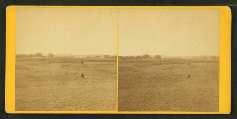
Fort Hays, Kansas, 580 miles west of St. Louis, Mo.
Publisher: Gardner's Photographic Art Gallery
Photographer: Gardner, Alexander (1821-1882)
Subjects: Fort Hays (Kan.), Plains
Collection: NYPL Digital Collections: Robert N. Dennis [From The New York Public Library]
Photographer: Gardner, Alexander (1821-1882)
Subjects: Fort Hays (Kan.), Plains
Collection: NYPL Digital Collections: Robert N. Dennis [From The New York Public Library]
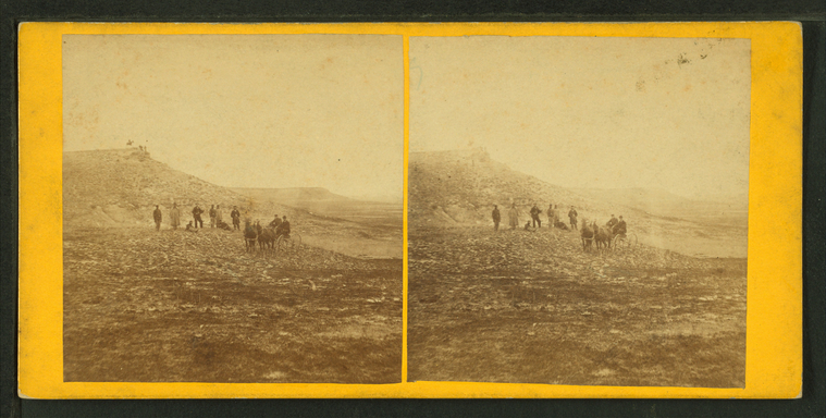
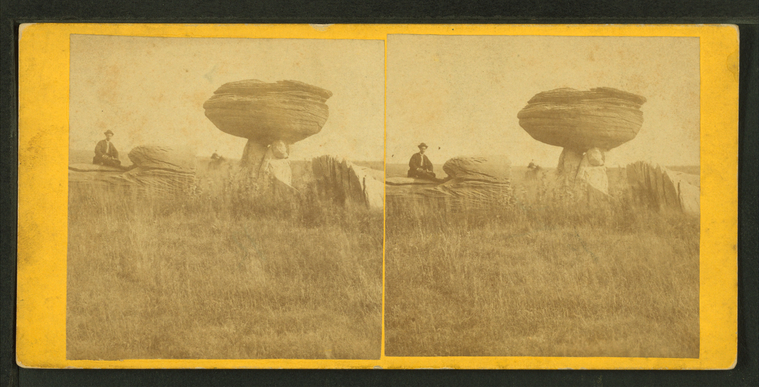
View of Mushroom Rock, Alum Creek, Kansas, 7 miles east of Fort Harker, and 496 miles west of St. Louis, Mo.
Publisher: Gardner's Photographic Art Gallery
Photographer: Gardner, Alexander (1821-1882)
Subjects: Rock formations, Kansas
Collection: NYPL Digital Collections: Robert N. Dennis [From The New York Public Library]
Photographer: Gardner, Alexander (1821-1882)
Subjects: Rock formations, Kansas
Collection: NYPL Digital Collections: Robert N. Dennis [From The New York Public Library]
![The Spiritwood Farms. [Row of horse plows lined up for work.] Stereoview Card](http://images.nypl.org/index.php?id=G92F111_022ZF&t=w&download=1&suffix=510d47e0-b704-a3d9-e040-e00a18064a99.001)
![Seeding. [Men with teams of horse plows seeding a field.] Stereoview Card](http://images.nypl.org/index.php?id=G92F111_021ZF&t=w&download=1&suffix=510d47e0-b702-a3d9-e040-e00a18064a99.001)
![Seeding. [Men with teams of horse plows seeding a field.] Stereoview Card](http://images.nypl.org/index.php?id=G92F111_020ZF&t=w&download=1&suffix=510d47e0-b700-a3d9-e040-e00a18064a99.001)


![Petrified stump, [...] diameter. Stereoview Card](http://images.nypl.org/index.php?id=G92F111_010F&t=w&download=1&suffix=510d47e0-b6ec-a3d9-e040-e00a18064a99.001)
![Traders store Ft. Berthold. [Native and Euro-Americans at the trading post at Fort Berthold Agency.] Stereoview Card](http://images.nypl.org/index.php?id=G92F111_006F&t=w&download=1&suffix=510d47e0-b6e4-a3d9-e040-e00a18064a99.001)
![Cascade Falls from below [...]. Stereoview Card](http://images.nypl.org/index.php?id=G92F111_005F&t=w&download=1&suffix=510d47e0-b6e2-a3d9-e040-e00a18064a99.001)
![Maiden of the BadLands [rock formation]. Stereoview Card](http://images.nypl.org/index.php?id=G92F111_004F&t=w&download=1&suffix=510d47e0-b6e0-a3d9-e040-e00a18064a99.001)
![Buffalo hunting, Yellowstone River. [Hunter posing with fallen bison.] Stereoview Card](http://images.nypl.org/index.php?id=G92F111_002F&t=w&download=1&suffix=510d47e0-b6dc-a3d9-e040-e00a18064a99.001)
