Houseworth, Thomas & Co.
Grading the Central Pacific Railroad. The cut at Owl Gap, Placer County.
Publisher: Houseworth, Thomas & Co.
Subjects: California
Collection: NYPL Digital Collections: Robert N. Dennis [From The New York Public Library]
Subjects: California
Collection: NYPL Digital Collections: Robert N. Dennis [From The New York Public Library]
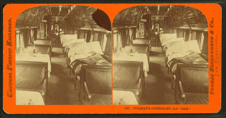
Pullman's commissary car "Gem."
Publisher: Houseworth, Thomas & Co.
Subjects: California
Collection: NYPL Digital Collections: Robert N. Dennis [From The New York Public Library]
Subjects: California
Collection: NYPL Digital Collections: Robert N. Dennis [From The New York Public Library]
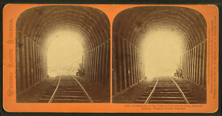
Looking out of the tunnel at Livermore Pass, Alameda County, Western Pacific Railroad.
Publisher: Houseworth, Thomas & Co.
Subjects: California
Collection: NYPL Digital Collections: Robert N. Dennis [From The New York Public Library]
Subjects: California
Collection: NYPL Digital Collections: Robert N. Dennis [From The New York Public Library]
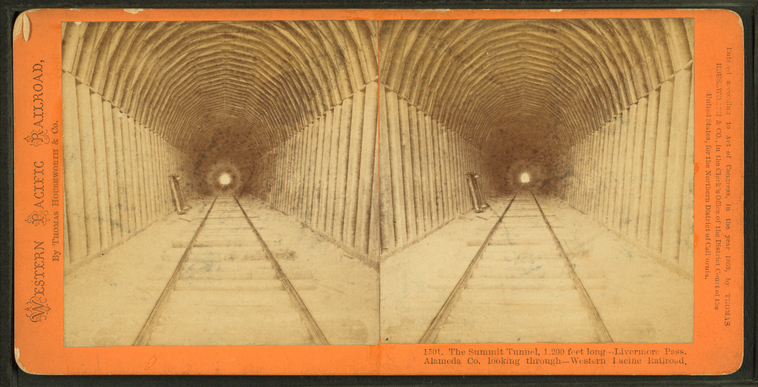
The Summit Tunnel, 1,200 feet long, Livermore Pass, Alameda Co. looking through, Western Pacific Railroad.
Publisher: Houseworth, Thomas & Co.
Subjects: California
Collection: NYPL Digital Collections: Robert N. Dennis [From The New York Public Library]
Subjects: California
Collection: NYPL Digital Collections: Robert N. Dennis [From The New York Public Library]
The Summit Tunnel, 1,200 feet long, Livermore Pass.
Publisher: Houseworth, Thomas & Co.
Subjects: California
Collection: NYPL Digital Collections: Robert N. Dennis [From The New York Public Library]
Subjects: California
Collection: NYPL Digital Collections: Robert N. Dennis [From The New York Public Library]
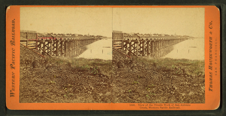
View of the trestle work of San Antonio Creek, Western Pacific Railroad.
Publisher: Houseworth, Thomas & Co.
Subjects: California
Collection: NYPL Digital Collections: Robert N. Dennis [From The New York Public Library]
Subjects: California
Collection: NYPL Digital Collections: Robert N. Dennis [From The New York Public Library]
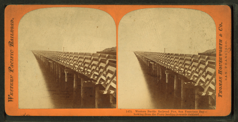
Western Pacific Railroad Pier, San Francisco Bay, looking from the ferry landing towards Oakland.
Publisher: Houseworth, Thomas & Co.
Subjects: California
Collection: NYPL Digital Collections: Robert N. Dennis [From The New York Public Library]
Subjects: California
Collection: NYPL Digital Collections: Robert N. Dennis [From The New York Public Library]
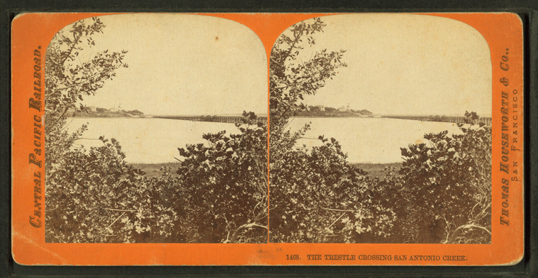
The trestle crossing San Antonio Creek.
Publisher: Houseworth, Thomas & Co.
Subjects: California
Collection: NYPL Digital Collections: Robert N. Dennis [From The New York Public Library]
Subjects: California
Collection: NYPL Digital Collections: Robert N. Dennis [From The New York Public Library]
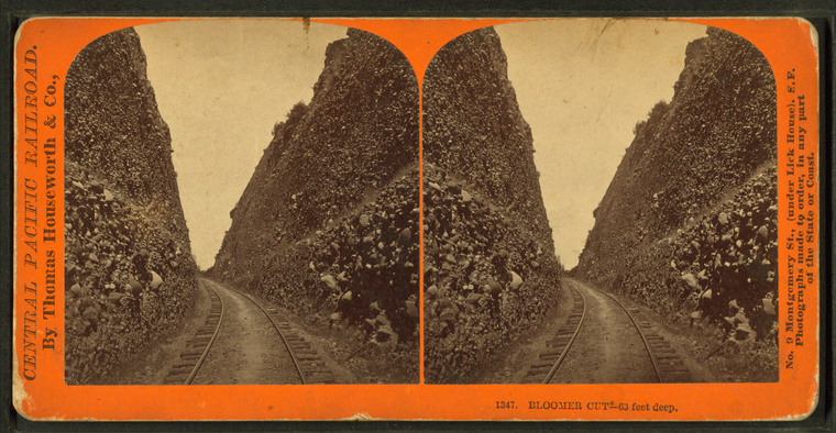
Bloomer Cut, 63 feet deep.
Publisher: Houseworth, Thomas & Co.
Subjects: California
Collection: NYPL Digital Collections: Robert N. Dennis [From The New York Public Library]
Subjects: California
Collection: NYPL Digital Collections: Robert N. Dennis [From The New York Public Library]
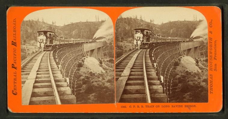
C.P.R.R. train on Long Ravine Bridge.
Publisher: Houseworth, Thomas & Co.
Subjects: California
Collection: NYPL Digital Collections: Robert N. Dennis [From The New York Public Library]
Subjects: California
Collection: NYPL Digital Collections: Robert N. Dennis [From The New York Public Library]
Central Pacific Railroad.
Publisher: Houseworth, Thomas & Co.
Subjects: California
Collection: NYPL Digital Collections: Robert N. Dennis [From The New York Public Library]
Subjects: California
Collection: NYPL Digital Collections: Robert N. Dennis [From The New York Public Library]
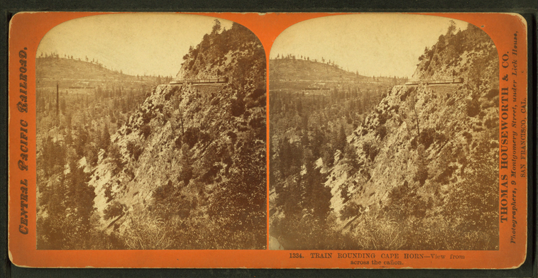
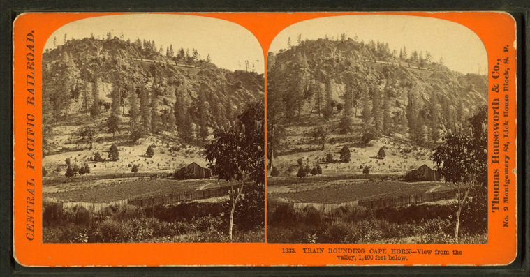
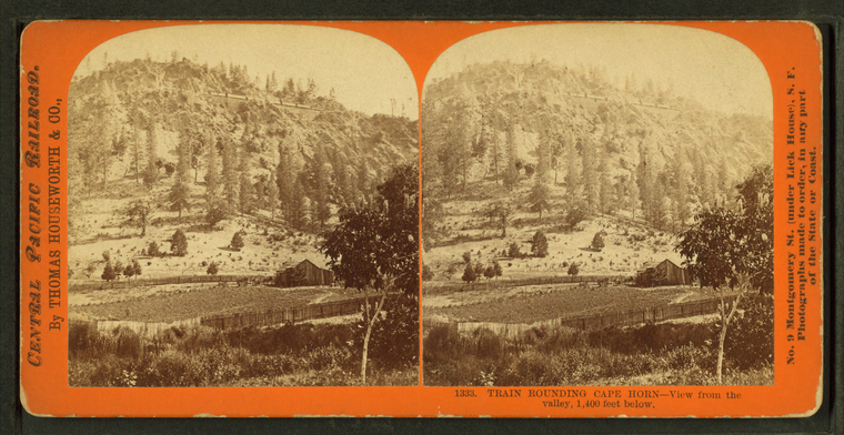
Train rounding Cape Horn, view from the valley, 1,400 feet below.
Publisher: Houseworth, Thomas & Co.
Subjects: California
Collection: NYPL Digital Collections: Robert N. Dennis [From The New York Public Library]
Subjects: California
Collection: NYPL Digital Collections: Robert N. Dennis [From The New York Public Library]
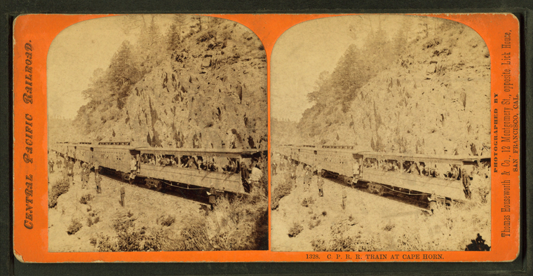
C.P.R.R. train at Cape Horn.
Publisher: Houseworth, Thomas & Co.
Subjects: California
Collection: NYPL Digital Collections: Robert N. Dennis [From The New York Public Library]
Subjects: California
Collection: NYPL Digital Collections: Robert N. Dennis [From The New York Public Library]
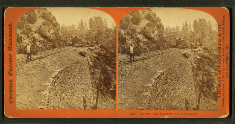
Stone embankment at Cape Horn.
Publisher: Houseworth, Thomas & Co.
Subjects: California
Collection: NYPL Digital Collections: Robert N. Dennis [From The New York Public Library]
Subjects: California
Collection: NYPL Digital Collections: Robert N. Dennis [From The New York Public Library]
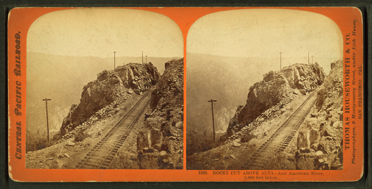
Rocky cut above Alta, and American River, 2,000 feet below.
Publisher: Houseworth, Thomas & Co.
Subjects: California
Collection: NYPL Digital Collections: Robert N. Dennis [From The New York Public Library]
Subjects: California
Collection: NYPL Digital Collections: Robert N. Dennis [From The New York Public Library]
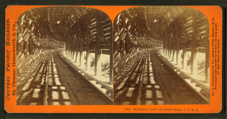
Interior view of snow shed, C.P.R.R.
Publisher: Houseworth, Thomas & Co.
Subjects: California
Collection: NYPL Digital Collections: Robert N. Dennis [From The New York Public Library]
Subjects: California
Collection: NYPL Digital Collections: Robert N. Dennis [From The New York Public Library]
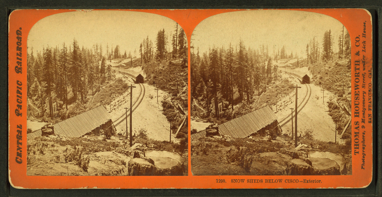
Snow sheds below Cisco, exterior.
Publisher: Houseworth, Thomas & Co.
Subjects: California
Collection: NYPL Digital Collections: Robert N. Dennis [From The New York Public Library]
Subjects: California
Collection: NYPL Digital Collections: Robert N. Dennis [From The New York Public Library]
Truckee River at Verdi, east of the Sierra Nevada mountains, Nevada, Central Pacific R.R.
Publisher: Houseworth, Thomas & Co.
Subjects: California
Collection: NYPL Digital Collections: Robert N. Dennis [From The New York Public Library]
Subjects: California
Collection: NYPL Digital Collections: Robert N. Dennis [From The New York Public Library]
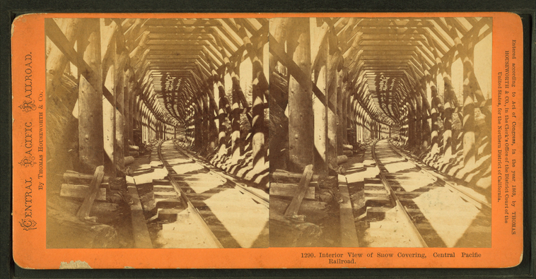
Interior view of snow covering, Central Pacific Railroad.
Publisher: Houseworth, Thomas & Co.
Subjects: California
Collection: NYPL Digital Collections: Robert N. Dennis [From The New York Public Library]
Subjects: California
Collection: NYPL Digital Collections: Robert N. Dennis [From The New York Public Library]
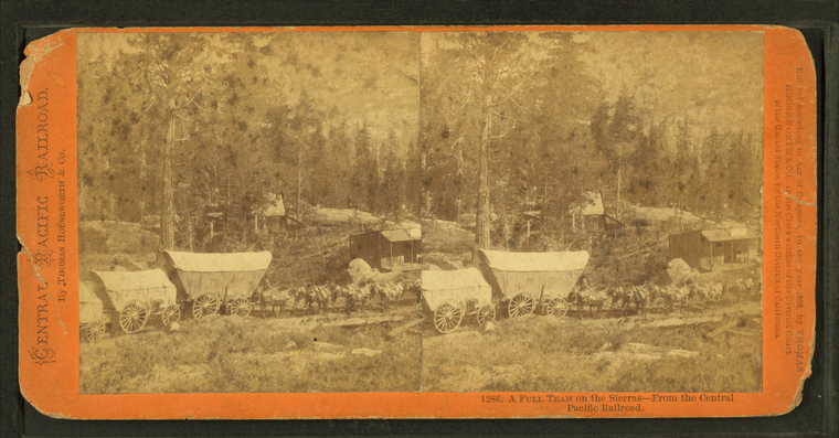
A full team on the Sierras, from the Central Pacific Railroad.
Publisher: Houseworth, Thomas & Co.
Subjects: California
Collection: NYPL Digital Collections: Robert N. Dennis [From The New York Public Library]
Subjects: California
Collection: NYPL Digital Collections: Robert N. Dennis [From The New York Public Library]
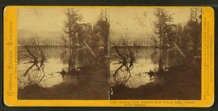
Evening view, southern shore Donner Lake, Central Pacific Railroad.
Publisher: Houseworth, Thomas & Co.
Subjects: California
Collection: NYPL Digital Collections: Robert N. Dennis [From The New York Public Library]
Subjects: California
Collection: NYPL Digital Collections: Robert N. Dennis [From The New York Public Library]
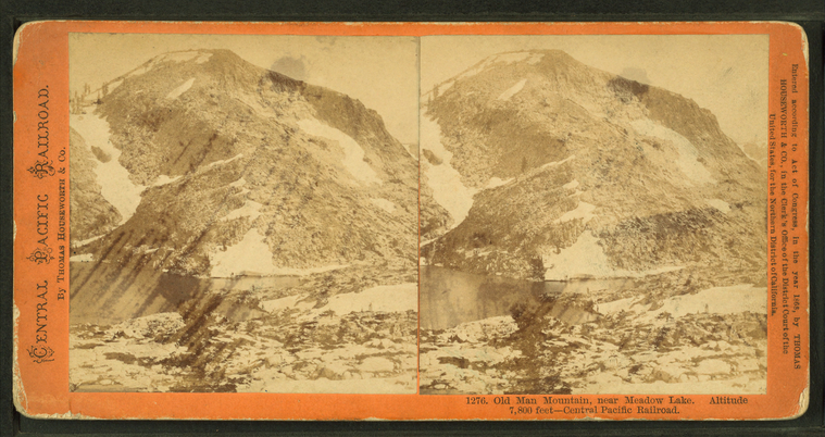
Old Man Mountain, near Meadow Lake. Altitude 7,800 feet, Central Pacific Railroad.
Publisher: Houseworth, Thomas & Co.
Subjects: California
Collection: NYPL Digital Collections: Robert N. Dennis [From The New York Public Library]
Subjects: California
Collection: NYPL Digital Collections: Robert N. Dennis [From The New York Public Library]
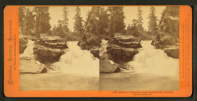
Falls on the Yuba River, near Crystal Lake, Central Pacific Railroad.
Publisher: Houseworth, Thomas & Co.
Subjects: California
Collection: NYPL Digital Collections: Robert N. Dennis [From The New York Public Library]
Subjects: California
Collection: NYPL Digital Collections: Robert N. Dennis [From The New York Public Library]
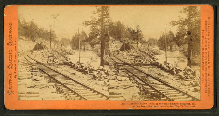
Truckee River, looking towards Eastern Summit, 135 miles from Sacramento, Central Pacific Railroad.
Publisher: Houseworth, Thomas & Co.
Subjects: California
Collection: NYPL Digital Collections: Robert N. Dennis [From The New York Public Library]
Subjects: California
Collection: NYPL Digital Collections: Robert N. Dennis [From The New York Public Library]
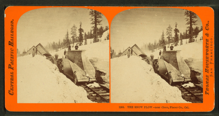
The snow plow, near Cisco, Placer County, Cal.
Publisher: Houseworth, Thomas & Co.
Subjects: California
Collection: NYPL Digital Collections: Robert N. Dennis [From The New York Public Library]
Subjects: California
Collection: NYPL Digital Collections: Robert N. Dennis [From The New York Public Library]
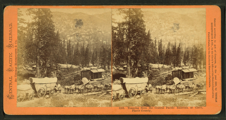
Teaming from the Central Pacific Railroad at Cisco, Placer County.
Publisher: Houseworth, Thomas & Co.
Subjects: California, Wagon trains
Collection: NYPL Digital Collections: Robert N. Dennis [From The New York Public Library]
Subjects: California, Wagon trains
Collection: NYPL Digital Collections: Robert N. Dennis [From The New York Public Library]
Railroad depot at Cisco.
Publisher: Houseworth, Thomas & Co.
Subjects: California
Collection: NYPL Digital Collections: Robert N. Dennis [From The New York Public Library]
Subjects: California
Collection: NYPL Digital Collections: Robert N. Dennis [From The New York Public Library]
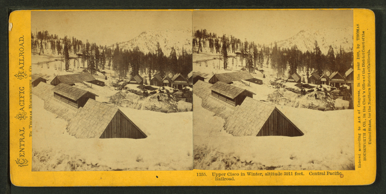
Upper Cisco in winter,altitude 5911 feet. Central Pacific Railroad.
Publisher: Houseworth, Thomas & Co.
Subjects: California
Collection: NYPL Digital Collections: Robert N. Dennis [From The New York Public Library]
Subjects: California
Collection: NYPL Digital Collections: Robert N. Dennis [From The New York Public Library]

