Bradley & Rulofson
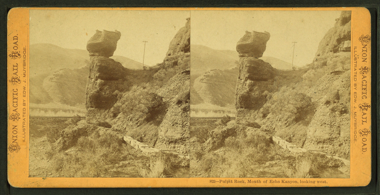
Pulpit Rock, mouth of Echo Canyon, looking west.
Publisher: Bradley & Rulofson
Photographer: Muybridge, Eadweard (1830-1904)
Subjects: Echo Canyon (Utah), Mountain roads, Pulpit Rock (Utah)
Collection: NYPL Digital Collections: Robert N. Dennis [From The New York Public Library]
Photographer: Muybridge, Eadweard (1830-1904)
Subjects: Echo Canyon (Utah), Mountain roads, Pulpit Rock (Utah)
Collection: NYPL Digital Collections: Robert N. Dennis [From The New York Public Library]
Thousand mile tree, 1000 miles West of Omaha.
Publisher: Bradley & Rulofson
Photographer: Muybridge, Eadweard (1830-1904)
Subjects: Trees, Railroad tracks, Ogden (Utah)
Collection: NYPL Digital Collections: Robert N. Dennis [From The New York Public Library]
Photographer: Muybridge, Eadweard (1830-1904)
Subjects: Trees, Railroad tracks, Ogden (Utah)
Collection: NYPL Digital Collections: Robert N. Dennis [From The New York Public Library]
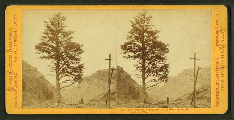
Thousand mile tree, 1000 miles West of Omaha, looking west.
Publisher: Bradley & Rulofson
Photographer: Muybridge, Eadweard (1830-1904)
Subjects: Trees, Railroad tracks, Ogden (Utah)
Collection: NYPL Digital Collections: Robert N. Dennis [From The New York Public Library]
Photographer: Muybridge, Eadweard (1830-1904)
Subjects: Trees, Railroad tracks, Ogden (Utah)
Collection: NYPL Digital Collections: Robert N. Dennis [From The New York Public Library]
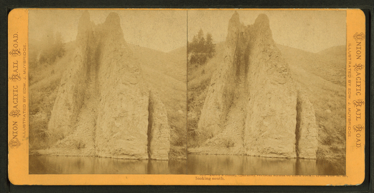
Devil's Slide (parallel vertical strata of hard rock) from the railroad, looking south.
Publisher: Bradley & Rulofson
Photographer: Muybridge, Eadweard (1830-1904)
Subjects: Utah, Rock formations, Devils Slide (Morgan County, Utah : Slope)
Collection: NYPL Digital Collections: Robert N. Dennis [From The New York Public Library]
Photographer: Muybridge, Eadweard (1830-1904)
Subjects: Utah, Rock formations, Devils Slide (Morgan County, Utah : Slope)
Collection: NYPL Digital Collections: Robert N. Dennis [From The New York Public Library]
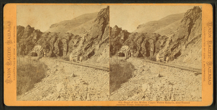
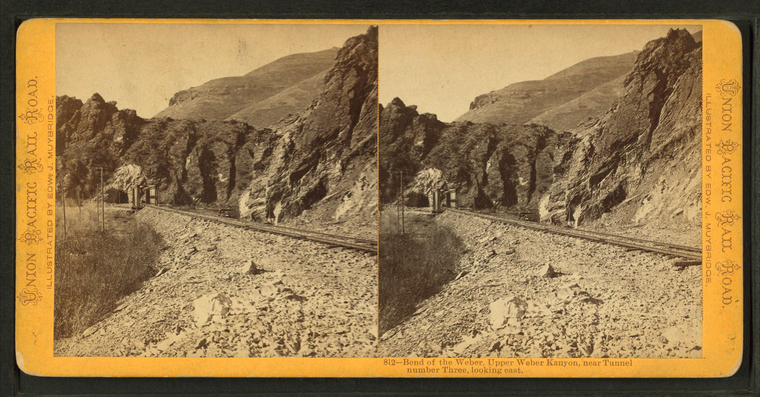
Bend of the Weber, Upper Weber Kanyon, near Tunnel No. Three, looking east.
Publisher: Bradley & Rulofson
Photographer: Muybridge, Eadweard (1830-1904)
Subjects: Utah, Railroad tunnels, Weber Canyon (Utah)
Collection: NYPL Digital Collections: Robert N. Dennis [From The New York Public Library]
Photographer: Muybridge, Eadweard (1830-1904)
Subjects: Utah, Railroad tunnels, Weber Canyon (Utah)
Collection: NYPL Digital Collections: Robert N. Dennis [From The New York Public Library]
Bend of the Weber, Upper Weber Kanyon, near Tunnel no. Three looking, east.
Publisher: Bradley & Rulofson
Photographer: Muybridge, Eadweard (1830-1904)
Subjects: Utah, Railroad tunnels, Weber Canyon (Utah)
Collection: NYPL Digital Collections: Robert N. Dennis [From The New York Public Library]
Photographer: Muybridge, Eadweard (1830-1904)
Subjects: Utah, Railroad tunnels, Weber Canyon (Utah)
Collection: NYPL Digital Collections: Robert N. Dennis [From The New York Public Library]
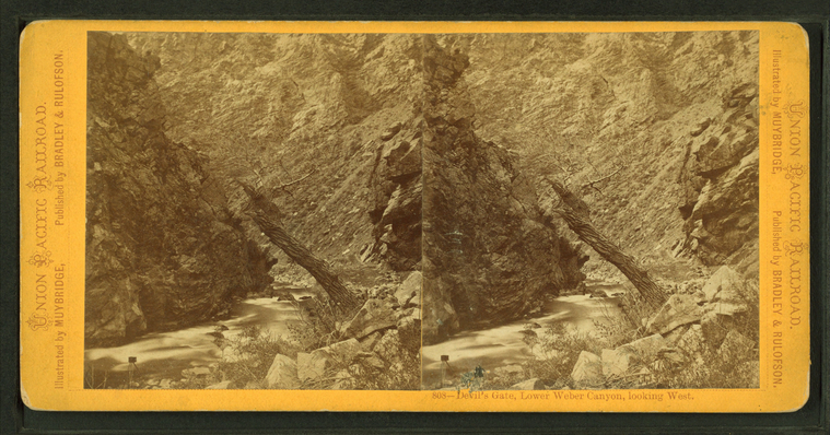
Devil's Gate, Lower Weber Canyon, looking west.
Publisher: Bradley & Rulofson
Photographer: Muybridge, Eadweard (1830-1904)
Subjects: Weber Canyon (Utah), Rivers
Collection: NYPL Digital Collections: Robert N. Dennis [From The New York Public Library]
Photographer: Muybridge, Eadweard (1830-1904)
Subjects: Weber Canyon (Utah), Rivers
Collection: NYPL Digital Collections: Robert N. Dennis [From The New York Public Library]
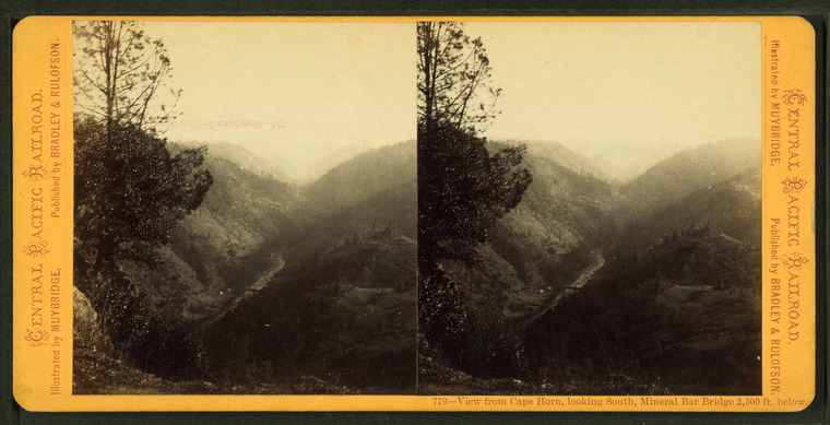
View from Cape Horn, looking South, Mineral Bar Bridge 2,500 feet below.
Publisher: Bradley & Rulofson
Photographer: Muybridge, Eadweard (1830-1904)
Subjects: Bridges, Cliffs
Collection: NYPL Digital Collections: Robert N. Dennis [From The New York Public Library]
Photographer: Muybridge, Eadweard (1830-1904)
Subjects: Bridges, Cliffs
Collection: NYPL Digital Collections: Robert N. Dennis [From The New York Public Library]
Cape Horn from Mineral Bar Bridge, 2500 feet below.
Publisher: Bradley & Rulofson
Photographer: Muybridge, Eadweard (1830-1904)
Subjects: Bridges, Cliffs
Collection: NYPL Digital Collections: Robert N. Dennis [From The New York Public Library]
Photographer: Muybridge, Eadweard (1830-1904)
Subjects: Bridges, Cliffs
Collection: NYPL Digital Collections: Robert N. Dennis [From The New York Public Library]
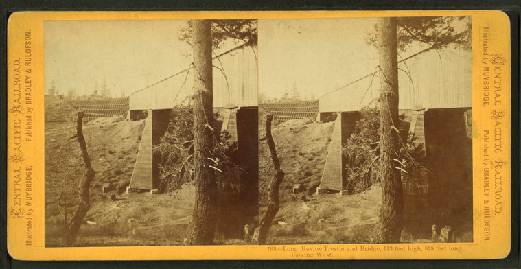
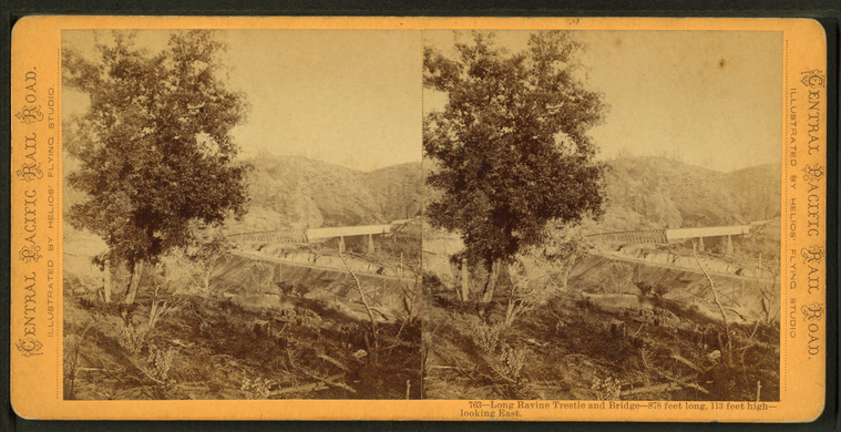
Long ravine trestle and bridge, 113 feet high, 878 feet long, looking west.
Publisher: Bradley & Rulofson
Photographer: Muybridge, Eadweard (1830-1904)
Subjects: Bridges, Trestles
Collection: NYPL Digital Collections: Robert N. Dennis [From The New York Public Library]
Photographer: Muybridge, Eadweard (1830-1904)
Subjects: Bridges, Trestles
Collection: NYPL Digital Collections: Robert N. Dennis [From The New York Public Library]
Long ravine trestle and bridge - 878 feet long, 113 feet high looking east.
Publisher: Bradley & Rulofson
Photographer: Muybridge, Eadweard (1830-1904)
Subjects: Bridges, Trestles
Collection: NYPL Digital Collections: Robert N. Dennis [From The New York Public Library]
Photographer: Muybridge, Eadweard (1830-1904)
Subjects: Bridges, Trestles
Collection: NYPL Digital Collections: Robert N. Dennis [From The New York Public Library]
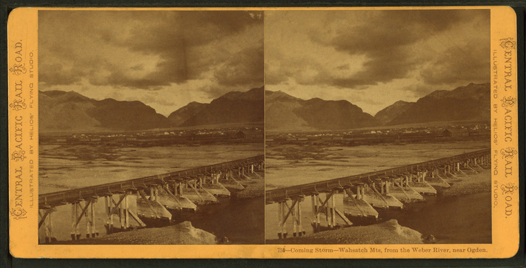
Coming storm - Wasatch Mountains, from the Weber River, near Ogden.
Publisher: Bradley & Rulofson
Photographer: Muybridge, Eadweard (1830-1904)
Subjects: Weber River (Utah), Wasatch Range (Utah and Idaho)
Collection: NYPL Digital Collections: Robert N. Dennis [From The New York Public Library]
Photographer: Muybridge, Eadweard (1830-1904)
Subjects: Weber River (Utah), Wasatch Range (Utah and Idaho)
Collection: NYPL Digital Collections: Robert N. Dennis [From The New York Public Library]
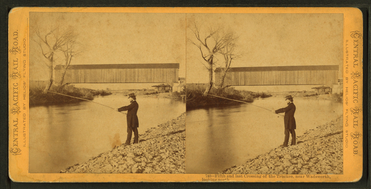
Fifth and last crossing of the Truckee, near Wadsworth, looking north.
Publisher: Bradley & Rulofson
Photographer: Muybridge, Eadweard (1830-1904)
Subjects: Men, Fishing, Truckee River (Calif. and Nev.)
Collection: NYPL Digital Collections: Robert N. Dennis [From The New York Public Library]
Photographer: Muybridge, Eadweard (1830-1904)
Subjects: Men, Fishing, Truckee River (Calif. and Nev.)
Collection: NYPL Digital Collections: Robert N. Dennis [From The New York Public Library]
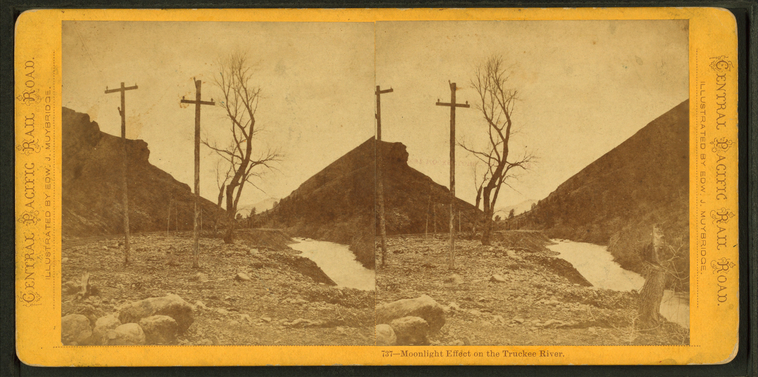
Moonlight effect on the Truckee River.
Publisher: Bradley & Rulofson
Photographer: Muybridge, Eadweard (1830-1904)
Subjects: Moonlight, Truckee River (Calif. and Nev.)
Collection: NYPL Digital Collections: Robert N. Dennis [From The New York Public Library]
Photographer: Muybridge, Eadweard (1830-1904)
Subjects: Moonlight, Truckee River (Calif. and Nev.)
Collection: NYPL Digital Collections: Robert N. Dennis [From The New York Public Library]
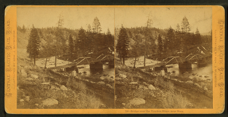
Bridge over the Truckee River, near Boca.
Publisher: Bradley & Rulofson
Photographer: Muybridge, Eadweard (1830-1904)
Subjects: Bridges, Truckee River (Calif. and Nev.)
Collection: NYPL Digital Collections: Robert N. Dennis [From The New York Public Library]
Photographer: Muybridge, Eadweard (1830-1904)
Subjects: Bridges, Truckee River (Calif. and Nev.)
Collection: NYPL Digital Collections: Robert N. Dennis [From The New York Public Library]
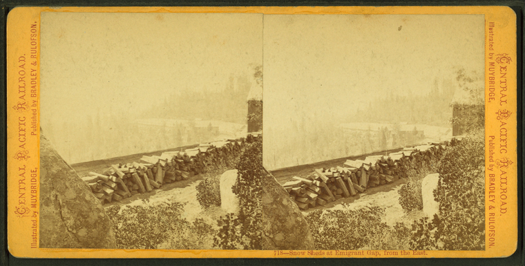
Snow sheds at Emigrant Gap, from the east.
Publisher: Bradley & Rulofson
Photographer: Muybridge, Eadweard (1830-1904)
Collection: NYPL Digital Collections: Robert N. Dennis [From The New York Public Library]
Photographer: Muybridge, Eadweard (1830-1904)
Collection: NYPL Digital Collections: Robert N. Dennis [From The New York Public Library]
Snow sheds from Cisco, from the west.
Publisher: Bradley & Rulofson
Photographer: Muybridge, Eadweard (1830-1904)
Collection: NYPL Digital Collections: Robert N. Dennis [From The New York Public Library]
Photographer: Muybridge, Eadweard (1830-1904)
Collection: NYPL Digital Collections: Robert N. Dennis [From The New York Public Library]
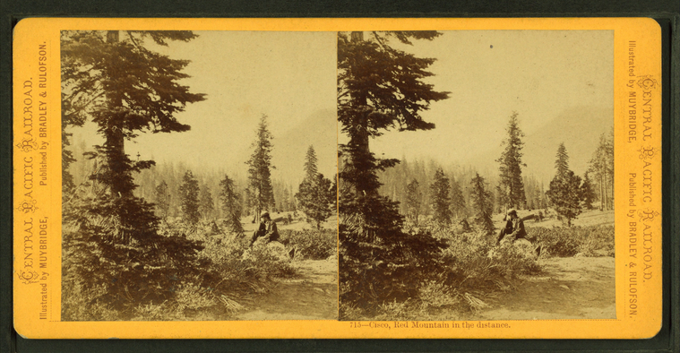
Cisco, Red Mountains in the distance.
Publisher: Bradley & Rulofson
Photographer: Muybridge, Eadweard (1830-1904)
Collection: NYPL Digital Collections: Robert N. Dennis [From The New York Public Library]
Photographer: Muybridge, Eadweard (1830-1904)
Collection: NYPL Digital Collections: Robert N. Dennis [From The New York Public Library]
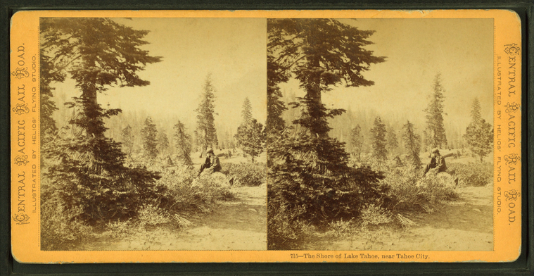
The shore of Lake Tahoe, near Tahoe City.
Publisher: Bradley & Rulofson
Photographer: Muybridge, Eadweard (1830-1904)
Collection: NYPL Digital Collections: Robert N. Dennis [From The New York Public Library]
Photographer: Muybridge, Eadweard (1830-1904)
Collection: NYPL Digital Collections: Robert N. Dennis [From The New York Public Library]
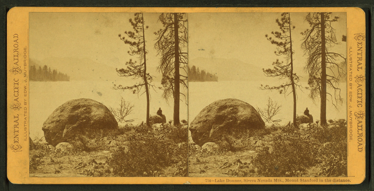
Lake Donner, Sierra Nevada Mts., Mount Stanford in the distance.
Publisher: Bradley & Rulofson
Photographer: Muybridge, Eadweard (1830-1904)
Subjects: California, Lakes & ponds, Sierra Nevada (Calif. and Nev.)
Collection: NYPL Digital Collections: Robert N. Dennis [From The New York Public Library]
Photographer: Muybridge, Eadweard (1830-1904)
Subjects: California, Lakes & ponds, Sierra Nevada (Calif. and Nev.)
Collection: NYPL Digital Collections: Robert N. Dennis [From The New York Public Library]
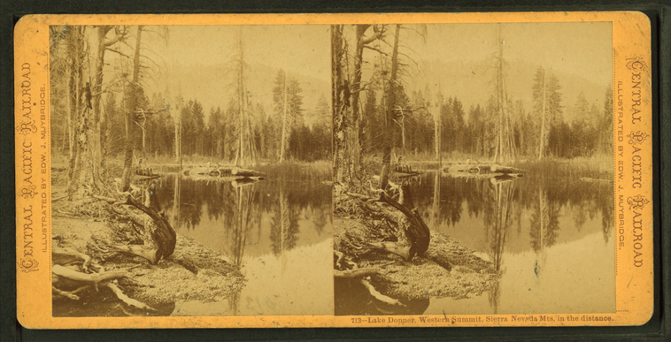
Lake Donner, Western Summit, Sierra Nevada Mts. in the distance.
Publisher: Bradley & Rulofson
Photographer: Muybridge, Eadweard (1830-1904)
Subjects: California, Lakes & ponds, Sierra Nevada (Calif. and Nev.)
Collection: NYPL Digital Collections: Robert N. Dennis [From The New York Public Library]
Photographer: Muybridge, Eadweard (1830-1904)
Subjects: California, Lakes & ponds, Sierra Nevada (Calif. and Nev.)
Collection: NYPL Digital Collections: Robert N. Dennis [From The New York Public Library]
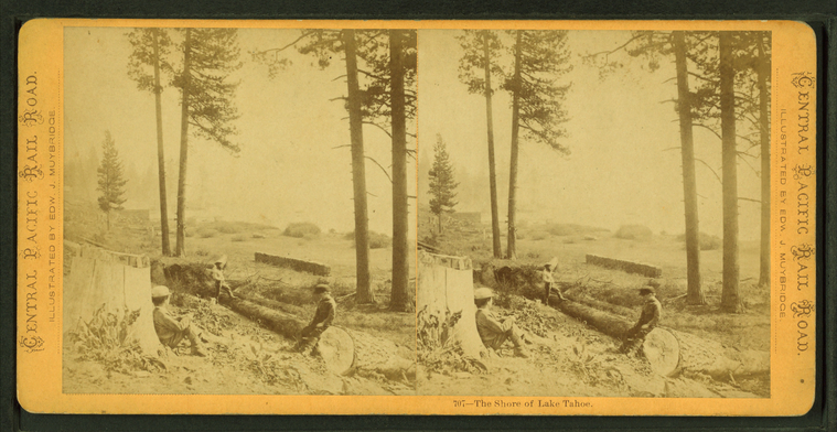
The shore of Lake Tahoe.
Publisher: Bradley & Rulofson
Photographer: Muybridge, Eadweard (1830-1904)
Collection: NYPL Digital Collections: Robert N. Dennis [From The New York Public Library]
Photographer: Muybridge, Eadweard (1830-1904)
Collection: NYPL Digital Collections: Robert N. Dennis [From The New York Public Library]
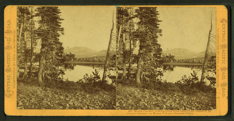
Mount Crocker, looking south from Lake Flora (crater of an extinct volcano) on Mount Volcano, Summit Valley.
Publisher: Bradley & Rulofson
Photographer: Muybridge, Eadweard (1830-1904)
Subjects: California, Lakes & ponds, Mountains, Craters
Collection: NYPL Digital Collections: Robert N. Dennis [From The New York Public Library]
Photographer: Muybridge, Eadweard (1830-1904)
Subjects: California, Lakes & ponds, Mountains, Craters
Collection: NYPL Digital Collections: Robert N. Dennis [From The New York Public Library]
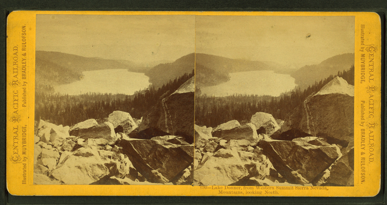
Lake Donner, from western summit Sierra Nevada Mountains, looking north.
Publisher: Bradley & Rulofson
Photographer: Muybridge, Eadweard (1830-1904)
Subjects: Sierra Nevada (Calif. and Nev.), Lakes & ponds, California, Mountains
Collection: NYPL Digital Collections: Robert N. Dennis [From The New York Public Library]
Photographer: Muybridge, Eadweard (1830-1904)
Subjects: Sierra Nevada (Calif. and Nev.), Lakes & ponds, California, Mountains
Collection: NYPL Digital Collections: Robert N. Dennis [From The New York Public Library]
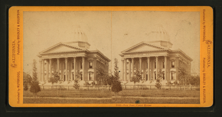
San Jose, Court House.
Publisher: Bradley & Rulofson
Photographer: Muybridge, Eadweard (1830-1904)
Subjects: California, San Jose (Calif.), Courthouses
Collection: NYPL Digital Collections: Robert N. Dennis [From The New York Public Library]
Photographer: Muybridge, Eadweard (1830-1904)
Subjects: California, San Jose (Calif.), Courthouses
Collection: NYPL Digital Collections: Robert N. Dennis [From The New York Public Library]
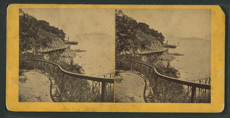
Black Point.
Publisher: Bradley & Rulofson
Photographer: Muybridge, Eadweard (1830-1904)
Subjects: California, San Francisco (Calif.)
Collection: NYPL Digital Collections: Robert N. Dennis [From The New York Public Library]
Photographer: Muybridge, Eadweard (1830-1904)
Subjects: California, San Francisco (Calif.)
Collection: NYPL Digital Collections: Robert N. Dennis [From The New York Public Library]
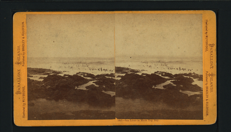
Sea Lions in Main Top Bay.
Publisher: Bradley & Rulofson
Photographer: Muybridge, Eadweard (1830-1904)
Subjects: California, Farallon Islands (Calif.), California, Bays, Sea lions
Collection: NYPL Digital Collections: Robert N. Dennis [From The New York Public Library]
Photographer: Muybridge, Eadweard (1830-1904)
Subjects: California, Farallon Islands (Calif.), California, Bays, Sea lions
Collection: NYPL Digital Collections: Robert N. Dennis [From The New York Public Library]
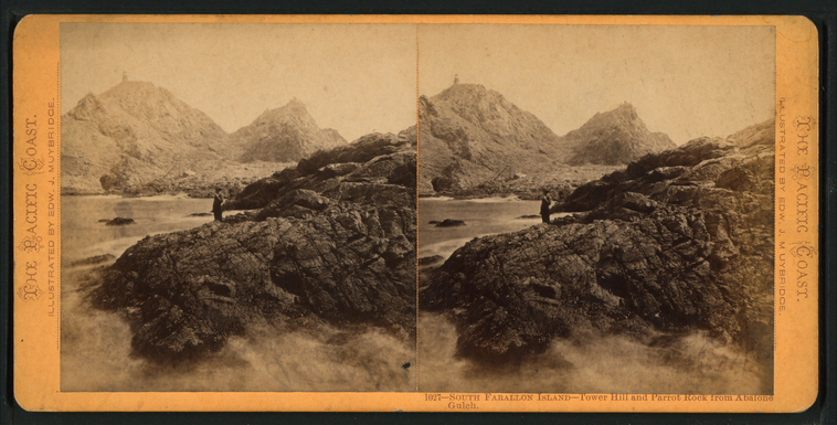
South Farallon Island - Tower Hill and Parrot Rock from Aballone Gulch.
Publisher: Bradley & Rulofson
Photographer: Muybridge, Eadweard (1830-1904)
Subjects: California, Farallon Islands (Calif.), California, Rock formations
Collection: NYPL Digital Collections: Robert N. Dennis [From The New York Public Library]
Photographer: Muybridge, Eadweard (1830-1904)
Subjects: California, Farallon Islands (Calif.), California, Rock formations
Collection: NYPL Digital Collections: Robert N. Dennis [From The New York Public Library]
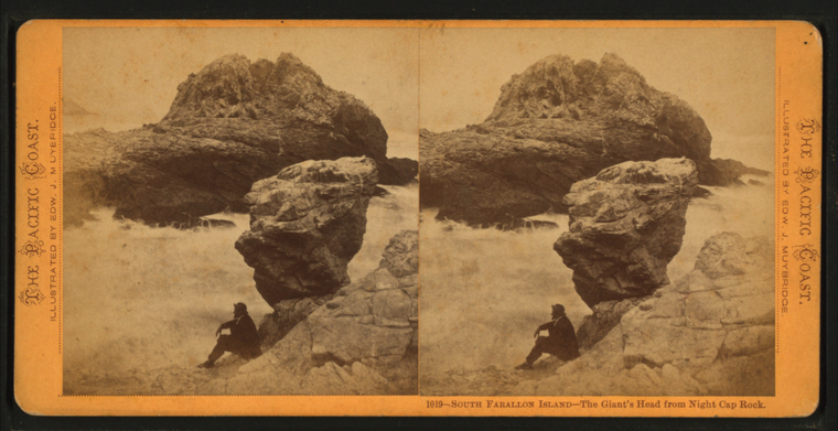
South Farallon Island - The Giant's Head from Night Cap Rock.
Publisher: Bradley & Rulofson
Photographer: Muybridge, Eadweard (1830-1904)
Subjects: California, Farallon Islands (Calif.), California, Rock formations
Collection: NYPL Digital Collections: Robert N. Dennis [From The New York Public Library]
Photographer: Muybridge, Eadweard (1830-1904)
Subjects: California, Farallon Islands (Calif.), California, Rock formations
Collection: NYPL Digital Collections: Robert N. Dennis [From The New York Public Library]
