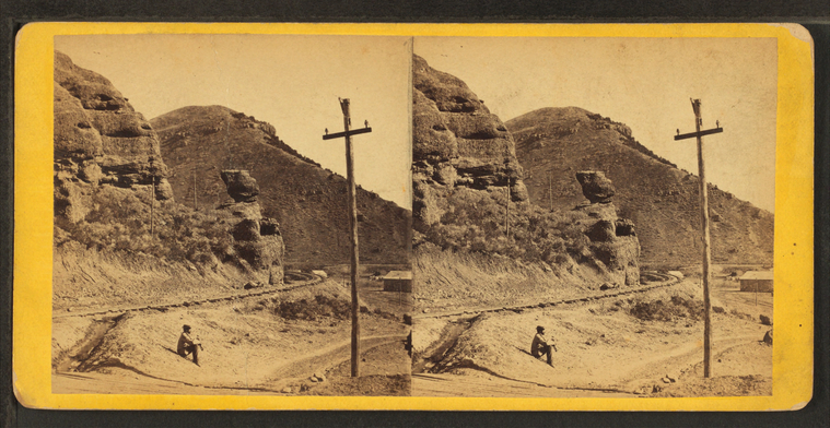
Pulpit Rock, Echo Canyon. Union Pacific Railroad.
Publisher: E. & H.T. Anthony & Co.
No.: 7140
Subjects: Utah, Utah, Canyons, Rock formations
Collection: NYPL Digital Collections: Robert N. Dennis [From The New York Public Library]
No.: 7140
Subjects: Utah, Utah, Canyons, Rock formations
Collection: NYPL Digital Collections: Robert N. Dennis [From The New York Public Library]
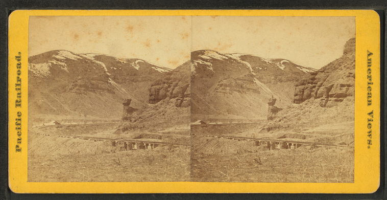
Index [Finger] Rock, Upper Weber Canyon, near Tunnel No. 3. Union Pacific Railroad.
Publisher: E. & H.T. Anthony & Co.
No.: 7135
Subjects: Utah, Utah, Canyons, Utah, Rock formations
Collection: NYPL Digital Collections: Robert N. Dennis [From The New York Public Library]
No.: 7135
Subjects: Utah, Utah, Canyons, Utah, Rock formations
Collection: NYPL Digital Collections: Robert N. Dennis [From The New York Public Library]
Lower Weber Canyon, looking west, Devil's Gate bridge in the foreground. Union Pacifc Railroad.
Publisher: E. & H.T. Anthony & Co.
No.: 7134
Subjects: Utah, Utah, Canyons, Railroad bridges
Collection: NYPL Digital Collections: Robert N. Dennis [From The New York Public Library]
No.: 7134
Subjects: Utah, Utah, Canyons, Railroad bridges
Collection: NYPL Digital Collections: Robert N. Dennis [From The New York Public Library]
Mount Anthony - summit of the Wahsatch [Wasatch] Mts. near Devils' Gate. Union Pacific Railroad.
Publisher: E. & H.T. Anthony & Co.
No.: 7131
Subjects: Utah, Utah, Canyons, Wasatch Range (Utah and Idaho)
Collection: NYPL Digital Collections: Robert N. Dennis [From The New York Public Library]
No.: 7131
Subjects: Utah, Utah, Canyons, Wasatch Range (Utah and Idaho)
Collection: NYPL Digital Collections: Robert N. Dennis [From The New York Public Library]
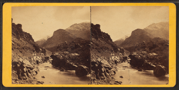
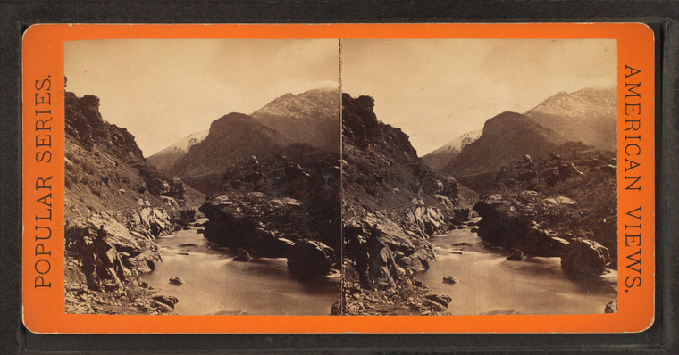
Looking east from the Devil's Gate, Lower Weber Canyon. Union Pacific Railroad.
Publisher: E. & H.T. Anthony & Co.
No.: 7129
Subjects: Utah, Utah, Canyons, Weber River (Utah)
Collection: NYPL Digital Collections: Robert N. Dennis [From The New York Public Library]
No.: 7129
Subjects: Utah, Utah, Canyons, Weber River (Utah)
Collection: NYPL Digital Collections: Robert N. Dennis [From The New York Public Library]
The notch in the Devil's Gate. Union Pacific Railroad.
Publisher: E. & H.T. Anthony & Co.
No.: 7130
Subjects: Utah, Utah, Canyons, Weber Canyon (Utah)
Collection: NYPL Digital Collections: Robert N. Dennis [From The New York Public Library]
No.: 7130
Subjects: Utah, Utah, Canyons, Weber Canyon (Utah)
Collection: NYPL Digital Collections: Robert N. Dennis [From The New York Public Library]
Looking east from the Devil's Gate. Lower Weber Canyon. Union Pacific Railroad.
Publisher: E. & H.T. Anthony & Co.
No.: 7129
Subjects: Utah, Utah, Canyons
Collection: NYPL Digital Collections: Robert N. Dennis [From The New York Public Library]
No.: 7129
Subjects: Utah, Utah, Canyons
Collection: NYPL Digital Collections: Robert N. Dennis [From The New York Public Library]
Devil's Gate from the south, the high peaks of the Wahsatch [Wasatch] in the distance. Union Pacific Railroad.
Publisher: E. & H.T. Anthony & Co.
No.: 7128
Subjects: Utah, Utah, Canyons, Railroad bridges
Collection: NYPL Digital Collections: Robert N. Dennis [From The New York Public Library]
No.: 7128
Subjects: Utah, Utah, Canyons, Railroad bridges
Collection: NYPL Digital Collections: Robert N. Dennis [From The New York Public Library]
Looking down at Devil's Gate bridge, the high peaks of the Wahsatch [Wasatch] in the distance.
Publisher: E. & H.T. Anthony & Co.
No.: 7127
Subjects: Utah, Utah, Canyons, Railroad bridges
Collection: NYPL Digital Collections: Robert N. Dennis [From The New York Public Library]
No.: 7127
Subjects: Utah, Utah, Canyons, Railroad bridges
Collection: NYPL Digital Collections: Robert N. Dennis [From The New York Public Library]
Looking east on Weber River, from Devil's Gate. Union Pacific Railroad.
Publisher: E. & H.T. Anthony & Co.
No.: 7126
Subjects: Utah, Utah, Canyons, Weber River (Utah)
Collection: NYPL Digital Collections: Robert N. Dennis [From The New York Public Library]
No.: 7126
Subjects: Utah, Utah, Canyons, Weber River (Utah)
Collection: NYPL Digital Collections: Robert N. Dennis [From The New York Public Library]
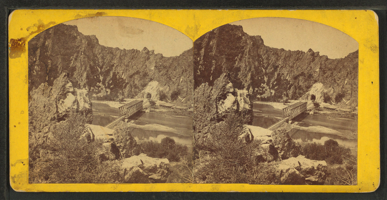
Devil'd Gate bridge. The peaks of the Wahsatch [Wasatch Range] in the distance.
Publisher: E. & H.T. Anthony & Co.
No.: 7127
Subjects: Utah, Utah, Canyons, Utah, Rock formations, Railroad bridges
Collection: NYPL Digital Collections: Robert N. Dennis [From The New York Public Library]
No.: 7127
Subjects: Utah, Utah, Canyons, Utah, Rock formations, Railroad bridges
Collection: NYPL Digital Collections: Robert N. Dennis [From The New York Public Library]
Monument Rock, Echo Kanyon [Canyon].
Series: Union Pacific R.R., West from Omaha. (2)
Subjects: Utah, Utah, Canyons, Utah, Rock formations
Collection: NYPL Digital Collections: Robert N. Dennis [From The New York Public Library]
Subjects: Utah, Utah, Canyons, Utah, Rock formations
Collection: NYPL Digital Collections: Robert N. Dennis [From The New York Public Library]
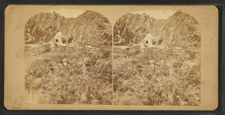
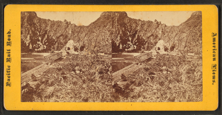
West End Tunnel No. 3.
Devil's Gate bridge.
Series: Union Pacific R.R., West from Omaha. (2)
Subjects: Utah, Utah, Canyons, Tunnels, Railroad bridges
Collection: NYPL Digital Collections: Robert N. Dennis [From The New York Public Library]
Subjects: Utah, Utah, Canyons, Tunnels, Railroad bridges
Collection: NYPL Digital Collections: Robert N. Dennis [From The New York Public Library]
Weber River near Devil's Slide.
Subjects: Utah, Utah, Canyons, Weber River (Utah)
Collection: NYPL Digital Collections: Robert N. Dennis [From The New York Public Library]
Collection: NYPL Digital Collections: Robert N. Dennis [From The New York Public Library]
Tunnel near Devil's Gate.
Subjects: Utah, Utah, Canyons, Utah, Railroad tunnels, Railroad bridges
Collection: NYPL Digital Collections: Robert N. Dennis [From The New York Public Library]
Collection: NYPL Digital Collections: Robert N. Dennis [From The New York Public Library]
Echo Canyon and Pulpit Rock.
Subjects: Utah, Utah, Canyons, Utah, Rock formations, Utah, Railroads
Collection: NYPL Digital Collections: Robert N. Dennis [From The New York Public Library]
Collection: NYPL Digital Collections: Robert N. Dennis [From The New York Public Library]
Witches Rocks, Weber River.
Subjects: Utah, Utah, Canyons, Utah, Rock formations, Weber River (Utah)
Collection: NYPL Digital Collections: Robert N. Dennis [From The New York Public Library]
Collection: NYPL Digital Collections: Robert N. Dennis [From The New York Public Library]
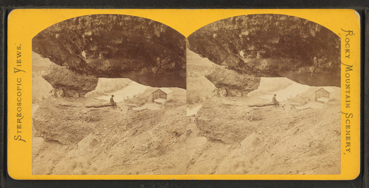
Hanging Rock, Echo City.
Series: Union Pacific. R.R. Stereoscopic Views. Across the Continent West from Omaha.
No.: 337
Subjects: Utah, Utah, Canyons, Utah, Rock formations
Collection: NYPL Digital Collections: Robert N. Dennis [From The New York Public Library]
No.: 337
Subjects: Utah, Utah, Canyons, Utah, Rock formations
Collection: NYPL Digital Collections: Robert N. Dennis [From The New York Public Library]
Weber River, Pacific Railroad.
Subjects: Utah, Utah, Canyons, Weber River (Utah)
Collection: NYPL Digital Collections: Robert N. Dennis [From The New York Public Library]
Collection: NYPL Digital Collections: Robert N. Dennis [From The New York Public Library]
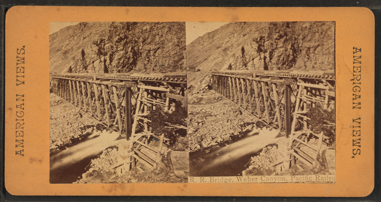
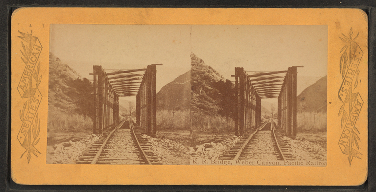
R.R. Bridge, Weber Canyon, Pacific Railroad.
Subjects: Utah, Utah, Canyons, Railroad bridges
Collection: NYPL Digital Collections: Robert N. Dennis [From The New York Public Library]
Collection: NYPL Digital Collections: Robert N. Dennis [From The New York Public Library]
R.R. Bridge, Weber Canyon, Pacific Railroad.
Subjects: Utah, Utah, Canyons, Railroad bridges
Collection: NYPL Digital Collections: Robert N. Dennis [From The New York Public Library]
Collection: NYPL Digital Collections: Robert N. Dennis [From The New York Public Library]
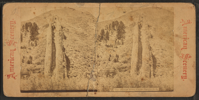
The Devil's Slide, Union Pacific R.R.
Subjects: Utah, Utah, Canyons
Collection: NYPL Digital Collections: Robert N. Dennis [From The New York Public Library]
Collection: NYPL Digital Collections: Robert N. Dennis [From The New York Public Library]
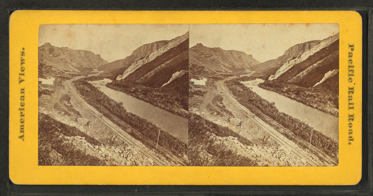
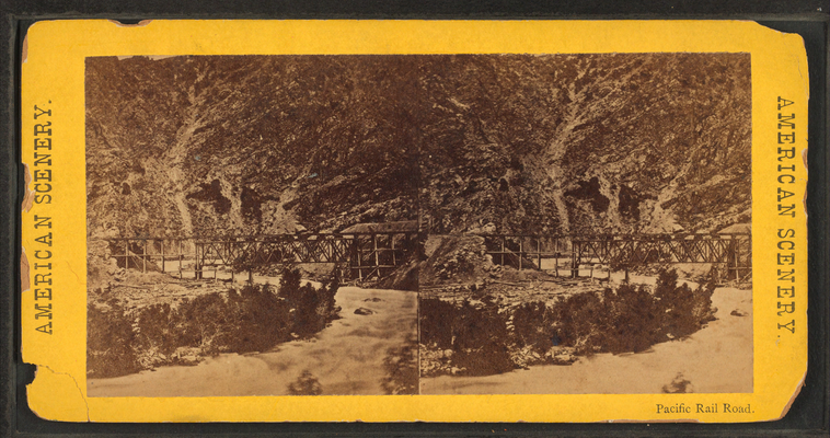
Pacific Rail Road.
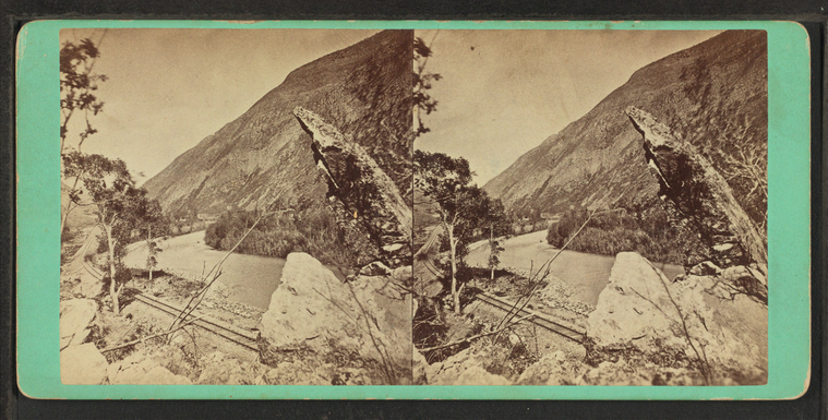
Finger Rock, Weber Canyon, Union Pacific R.R.
Subjects: Utah, Utah, Canyons, Utah, Rock formations
Collection: NYPL Digital Collections: Robert N. Dennis [From The New York Public Library]
Collection: NYPL Digital Collections: Robert N. Dennis [From The New York Public Library]
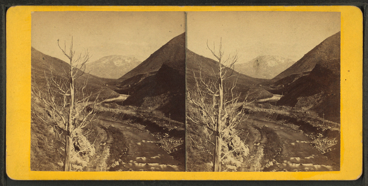
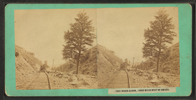
Tree Weber Canon, 1000 miles: west of Omaha.
Photographer: Carter, C.W.
Subjects: Utah, Utah, Canyons
Collection: NYPL Digital Collections: Robert N. Dennis [From The New York Public Library]
Subjects: Utah, Utah, Canyons
Collection: NYPL Digital Collections: Robert N. Dennis [From The New York Public Library]
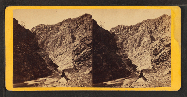
Weber Canon [Canyon].
Subjects: Utah, Utah, Canyons
Collection: NYPL Digital Collections: Robert N. Dennis [From The New York Public Library]
Collection: NYPL Digital Collections: Robert N. Dennis [From The New York Public Library]
Rocks in Echo Canon [Canyon].
Subjects: Utah, Utah, Canyons
Collection: NYPL Digital Collections: Robert N. Dennis [From The New York Public Library]
Collection: NYPL Digital Collections: Robert N. Dennis [From The New York Public Library]
Tunnel No. 2, Echo Cañon, U.P.R.R. [Union Pacific Railroad].
Subjects: Utah, Utah, Canyons
Collection: NYPL Digital Collections: Robert N. Dennis [From The New York Public Library]
Collection: NYPL Digital Collections: Robert N. Dennis [From The New York Public Library]
![Index [Finger] Rock, Upper Weber Canyon, near Tunnel No. 3. Union Pacific Railroad. Stereoview Card](http://images.nypl.org/index.php?id=G92F045_029F&t=w&download=1&suffix=510d47e1-b4aa-a3d9-e040-e00a18064a99.001)

![Mount Anthony - summit of the Wahsatch [Wasatch] Mts. near Devils' Gate. Union Pacific Railroad. Stereoview Card](http://images.nypl.org/index.php?id=G92F045_027F&t=w&download=1&suffix=510d47e1-b4a6-a3d9-e040-e00a18064a99.001)
![Devil's Gate from the south, the high peaks of the Wahsatch [Wasatch] in the distance. Union Pacific Railroad. Stereoview Card](http://images.nypl.org/index.php?id=G92F045_022F&t=w&download=1&suffix=510d47e1-b49c-a3d9-e040-e00a18064a99.001)
![Devil's Gate from the south, the high peaks of the Wahsatch [Wasatch] in the distance. Union Pacific Railroad. Stereoview Card](http://images.nypl.org/index.php?id=G92F045_023F&t=w&download=1&suffix=510d47e1-b49e-a3d9-e040-e00a18064a99.001)
![Looking down at Devil's Gate bridge, the high peaks of the Wahsatch [Wasatch] in the distance. Stereoview Card](http://images.nypl.org/index.php?id=G92F045_021F&t=w&download=1&suffix=510d47e1-b49a-a3d9-e040-e00a18064a99.001)
![Devil'd Gate bridge. The peaks of the Wahsatch [Wasatch Range] in the distance. Stereoview Card](http://images.nypl.org/index.php?id=G92F045_019F&t=w&download=1&suffix=510d47e1-b496-a3d9-e040-e00a18064a99.001)
![Monument Rock, Echo Kanyon [Canyon]. Stereoview Card](http://images.nypl.org/index.php?id=G92F045_018F&t=w&download=1&suffix=510d47e1-b494-a3d9-e040-e00a18064a99.001)


![Weber Canon [Canyon]. Stereoview Card](http://images.nypl.org/index.php?id=G92F045_003F&t=w&download=1&suffix=510d47e1-b476-a3d9-e040-e00a18064a99.001)
![Rocks in Echo Canon [Canyon]. Stereoview Card](http://images.nypl.org/index.php?id=G92F045_002F&t=w&download=1&suffix=510d47e1-b474-a3d9-e040-e00a18064a99.001)
![Tunnel No. 2, Echo Cañon, U.P.R.R. [Union Pacific Railroad]. Stereoview Card](http://images.nypl.org/index.php?id=G92F045_001F&t=w&download=1&suffix=510d47e1-b472-a3d9-e040-e00a18064a99.001)