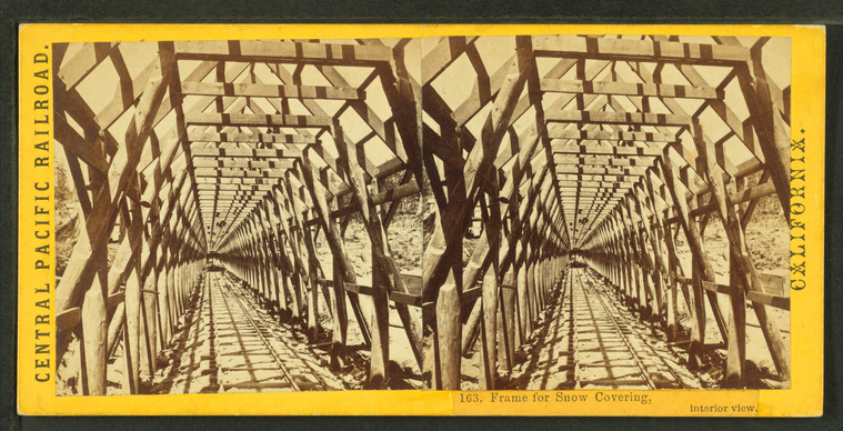
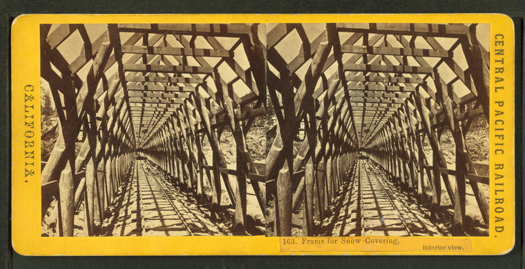
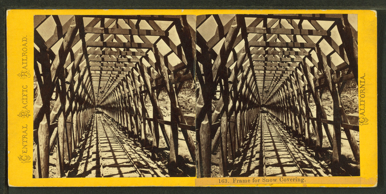
Frame for snow covering, interior view.
Publisher: Hart, Alfred A.
Photographer: Hart, Alfred A. (1816-1908)
Subjects: Sierra Nevada (Calif. and Nev.), Framing (Building), Snowsheds
Collection: NYPL Digital Collections: Robert N. Dennis [From The New York Public Library]
Photographer: Hart, Alfred A. (1816-1908)
Subjects: Sierra Nevada (Calif. and Nev.), Framing (Building), Snowsheds
Collection: NYPL Digital Collections: Robert N. Dennis [From The New York Public Library]
Frame for snow covering, interior view.
Publisher: Hart, Alfred A.
Photographer: Hart, Alfred A. (1816-1908)
Subjects: Sierra Nevada (Calif. and Nev.), Interiors, Structural frames, Snowsheds
Collection: NYPL Digital Collections: Robert N. Dennis [From The New York Public Library]
Photographer: Hart, Alfred A. (1816-1908)
Subjects: Sierra Nevada (Calif. and Nev.), Interiors, Structural frames, Snowsheds
Collection: NYPL Digital Collections: Robert N. Dennis [From The New York Public Library]
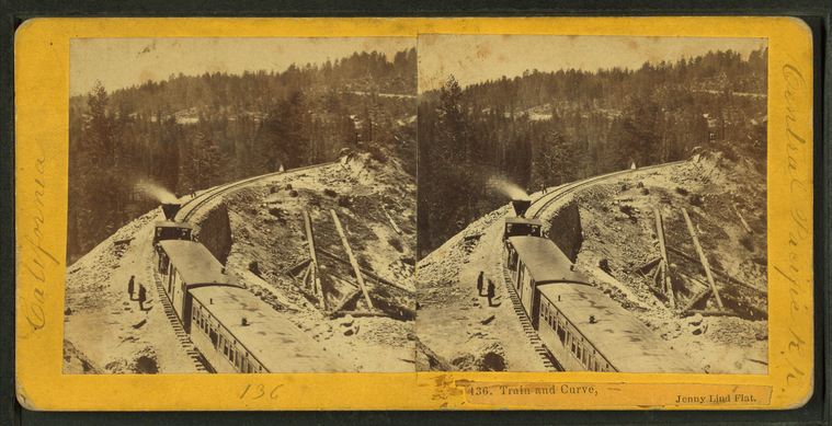
Train and Curve, Jenny Lind Flat.
Publisher: Hart, Alfred A.
Photographer: Hart, Alfred A. (1816-1908)
Subjects: Sierra Nevada (Calif. and Nev.), Railroad locomotives, Mountain railroads
Collection: NYPL Digital Collections: Robert N. Dennis [From The New York Public Library]
Photographer: Hart, Alfred A. (1816-1908)
Subjects: Sierra Nevada (Calif. and Nev.), Railroad locomotives, Mountain railroads
Collection: NYPL Digital Collections: Robert N. Dennis [From The New York Public Library]
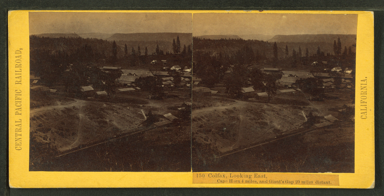
Colfax, looking East. Cape Horn 4 miles, Giant's Gap 20 miles distant.
Publisher: Hart, Alfred A.
Photographer: Hart, Alfred A. (1816-1908)
Subjects: Sierra Nevada (Calif. and Nev.), Dwellings, Colfax (Calif.)
Collection: NYPL Digital Collections: Robert N. Dennis [From The New York Public Library]
Photographer: Hart, Alfred A. (1816-1908)
Subjects: Sierra Nevada (Calif. and Nev.), Dwellings, Colfax (Calif.)
Collection: NYPL Digital Collections: Robert N. Dennis [From The New York Public Library]
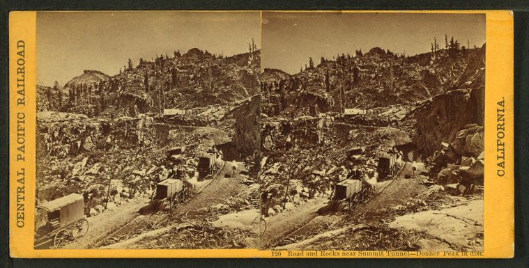
Road and rocks near Summit Tunnel, Donner Peak in dist.
Publisher: Hart, Alfred A.
Photographer: Hart, Alfred A. (1816-1908)
Subjects: Sierra Nevada (Calif. and Nev.), Mountains, Carts & wagons, Mountain roads
Collection: NYPL Digital Collections: Robert N. Dennis [From The New York Public Library]
Photographer: Hart, Alfred A. (1816-1908)
Subjects: Sierra Nevada (Calif. and Nev.), Mountains, Carts & wagons, Mountain roads
Collection: NYPL Digital Collections: Robert N. Dennis [From The New York Public Library]
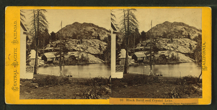
Black Butte and Crystal Lake, 90 miles from Sacramento.
Publisher: Hart, Alfred A.
Photographer: Hart, Alfred A. (1816-1908)
Subjects: Sierra Nevada (Calif. and Nev.), Mountains, Lakes & ponds, Houses
Collection: NYPL Digital Collections: Robert N. Dennis [From The New York Public Library]
Photographer: Hart, Alfred A. (1816-1908)
Subjects: Sierra Nevada (Calif. and Nev.), Mountains, Lakes & ponds, Houses
Collection: NYPL Digital Collections: Robert N. Dennis [From The New York Public Library]
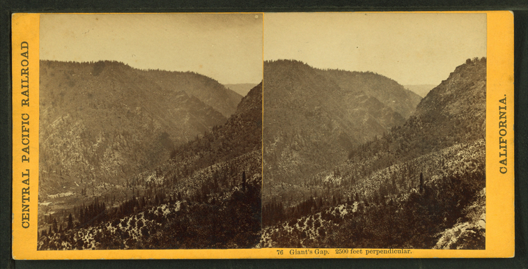
Giant's Gap, 2500 feet perpendicular.
Publisher: Hart, Alfred A.
Photographer: Hart, Alfred A. (1816-1908)
Subjects: Sierra Nevada (Calif. and Nev.), Mountains, Passes (Landforms)
Collection: NYPL Digital Collections: Robert N. Dennis [From The New York Public Library]
Photographer: Hart, Alfred A. (1816-1908)
Subjects: Sierra Nevada (Calif. and Nev.), Mountains, Passes (Landforms)
Collection: NYPL Digital Collections: Robert N. Dennis [From The New York Public Library]
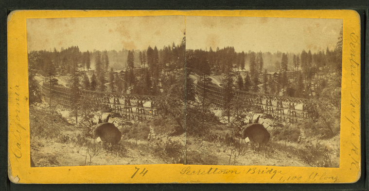
Secrettown Bridge, 1100 feet long.
Publisher: Hart, Alfred A.
Photographer: Hart, Alfred A. (1816-1908)
Subjects: Sierra Nevada (Calif. and Nev.), Trestles
Collection: NYPL Digital Collections: Robert N. Dennis [From The New York Public Library]
Photographer: Hart, Alfred A. (1816-1908)
Subjects: Sierra Nevada (Calif. and Nev.), Trestles
Collection: NYPL Digital Collections: Robert N. Dennis [From The New York Public Library]
Long Ravine Bridge near Colfax. [Train crossing].
Publisher: Hart, Alfred A.
Photographer: Hart, Alfred A. (1816-1908)
Subjects: Sierra Nevada (Calif. and Nev.), Railroad bridges, Railroad crossings
Collection: NYPL Digital Collections: Robert N. Dennis [From The New York Public Library]
Photographer: Hart, Alfred A. (1816-1908)
Subjects: Sierra Nevada (Calif. and Nev.), Railroad bridges, Railroad crossings
Collection: NYPL Digital Collections: Robert N. Dennis [From The New York Public Library]
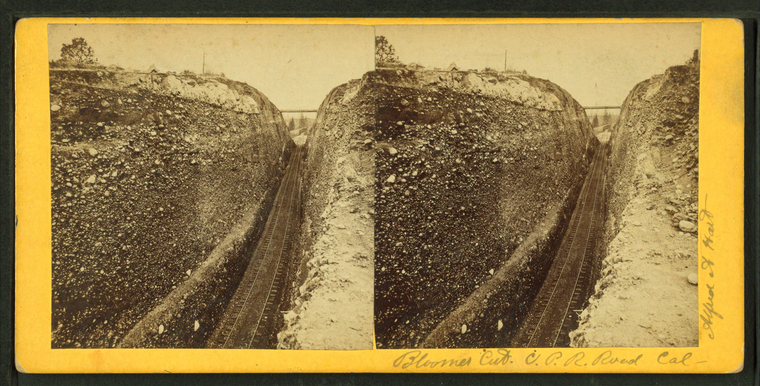
Bloomer Cut, C.P.R. Road, Calif.
Publisher: Hart, Alfred A.
Photographer: Hart, Alfred A. (1816-1908)
Subjects: Sierra Nevada (Calif. and Nev.), Mountain railroads
Collection: NYPL Digital Collections: Robert N. Dennis [From The New York Public Library]
Photographer: Hart, Alfred A. (1816-1908)
Subjects: Sierra Nevada (Calif. and Nev.), Mountain railroads
Collection: NYPL Digital Collections: Robert N. Dennis [From The New York Public Library]
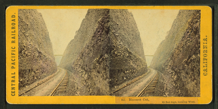
Bloomer Cut, 63 feet high, looking West.
Publisher: Hart, Alfred A.
Photographer: Hart, Alfred A. (1816-1908)
Subjects: Sierra Nevada (Calif. and Nev.), Mountain railroads
Collection: NYPL Digital Collections: Robert N. Dennis [From The New York Public Library]
Photographer: Hart, Alfred A. (1816-1908)
Subjects: Sierra Nevada (Calif. and Nev.), Mountain railroads
Collection: NYPL Digital Collections: Robert N. Dennis [From The New York Public Library]
![Long Ravine Bridge near Colfax. [Train crossing]. Stereoview Card](http://images.nypl.org/index.php?id=G92F102_003F&t=w&download=1&suffix=510d47e0-16af-a3d9-e040-e00a18064a99.001)
