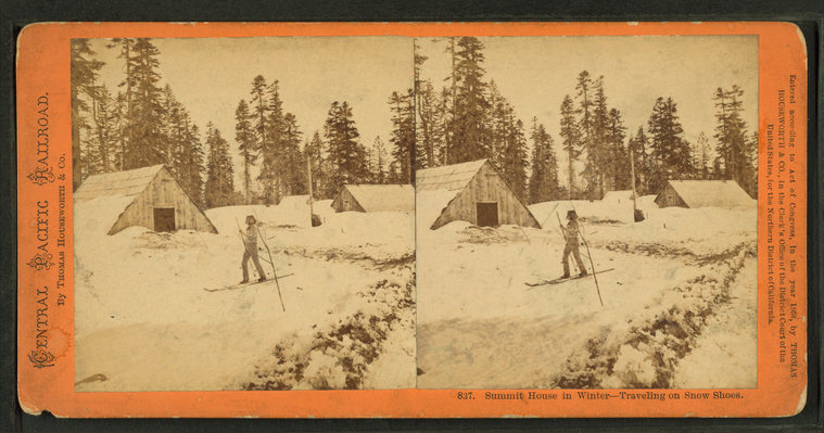
Summit House in winter, traveling on snow shoes.
Publisher: Houseworth, Thomas & Co.
Subjects: California
Collection: NYPL Digital Collections: Robert N. Dennis [From The New York Public Library]
Subjects: California
Collection: NYPL Digital Collections: Robert N. Dennis [From The New York Public Library]
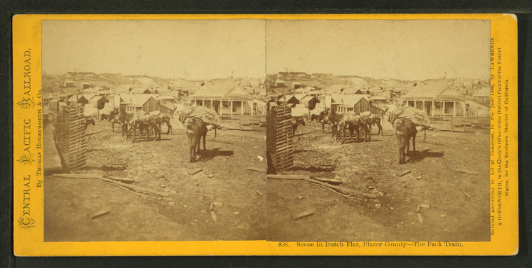
Scene in Dutch Flat, Placer County, the pack train.
Publisher: Houseworth, Thomas & Co.
Subjects: California, Packtrains
Collection: NYPL Digital Collections: Robert N. Dennis [From The New York Public Library]
Subjects: California, Packtrains
Collection: NYPL Digital Collections: Robert N. Dennis [From The New York Public Library]
Moonlight on the beach at Donner Lake.
Publisher: Houseworth, Thomas & Co.
Subjects: California
Collection: NYPL Digital Collections: Robert N. Dennis [From The New York Public Library]
Subjects: California
Collection: NYPL Digital Collections: Robert N. Dennis [From The New York Public Library]
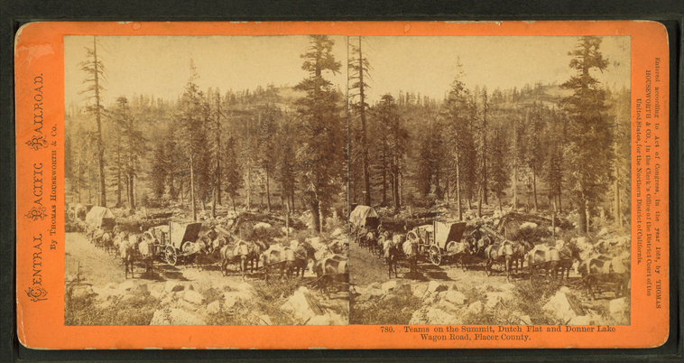
Teams on the summit, Dutch Flat and Donner Lake Wagon Road, Placer County.
Publisher: Houseworth, Thomas & Co.
Subjects: California
Collection: NYPL Digital Collections: Robert N. Dennis [From The New York Public Library]
Subjects: California
Collection: NYPL Digital Collections: Robert N. Dennis [From The New York Public Library]
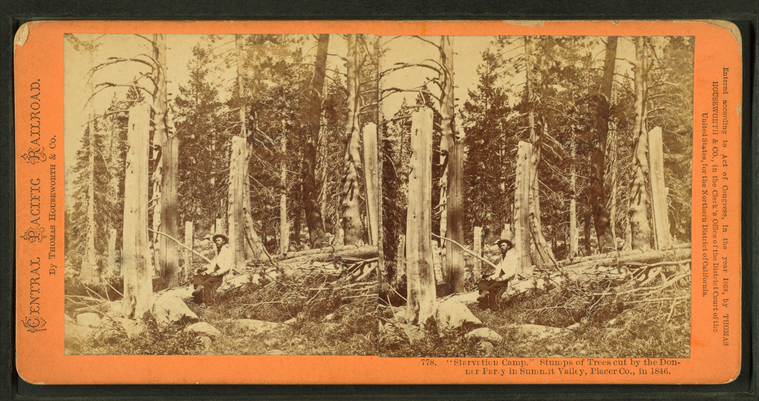
Starvation Camp." Stumps of trees cut by the Donner Party in Summit Valley, Placer Co., 1846.
Publisher: Houseworth, Thomas & Co.
Subjects: California, Donner Party
Collection: NYPL Digital Collections: Robert N. Dennis [From The New York Public Library]
Subjects: California, Donner Party
Collection: NYPL Digital Collections: Robert N. Dennis [From The New York Public Library]
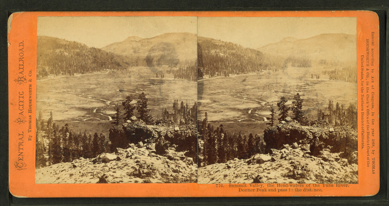
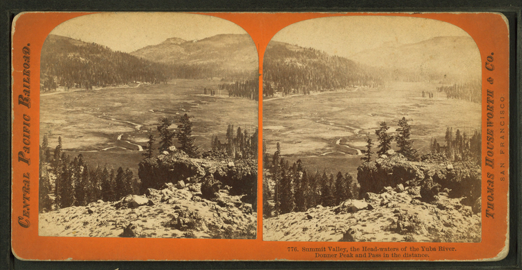
Summit Valley, the head-waters of the Yuba River. Donner Peak and Pass in the distance.
Publisher: Houseworth, Thomas & Co.
Subjects: California
Collection: NYPL Digital Collections: Robert N. Dennis [From The New York Public Library]
Subjects: California
Collection: NYPL Digital Collections: Robert N. Dennis [From The New York Public Library]
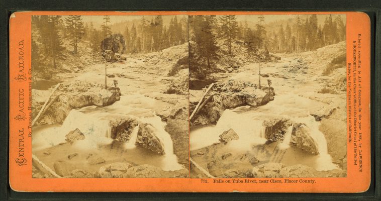
Falls on Yuba River, near Cisco, Placer County.
Publisher: Houseworth, Thomas & Co.
Subjects: California
Collection: NYPL Digital Collections: Robert N. Dennis [From The New York Public Library]
Subjects: California
Collection: NYPL Digital Collections: Robert N. Dennis [From The New York Public Library]
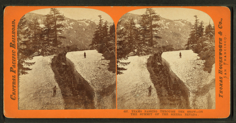
Teams passing through the snow, on the summit of the Sierra Nevada.
Publisher: Houseworth, Thomas & Co.
Subjects: California
Collection: NYPL Digital Collections: Robert N. Dennis [From The New York Public Library]
Subjects: California
Collection: NYPL Digital Collections: Robert N. Dennis [From The New York Public Library]
Group of Piute Indians.
Publisher: Houseworth, Thomas & Co.
Subjects: California, Paiute Indians
Collection: NYPL Digital Collections: Robert N. Dennis [From The New York Public Library]
Subjects: California, Paiute Indians
Collection: NYPL Digital Collections: Robert N. Dennis [From The New York Public Library]
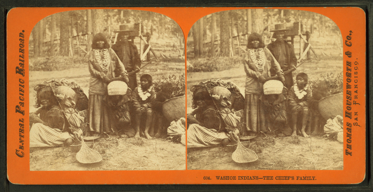
Washoe Indians, the chief's family.
Publisher: Houseworth, Thomas & Co.
Subjects: California, Washo Indians
Collection: NYPL Digital Collections: Robert N. Dennis [From The New York Public Library]
Subjects: California, Washo Indians
Collection: NYPL Digital Collections: Robert N. Dennis [From The New York Public Library]
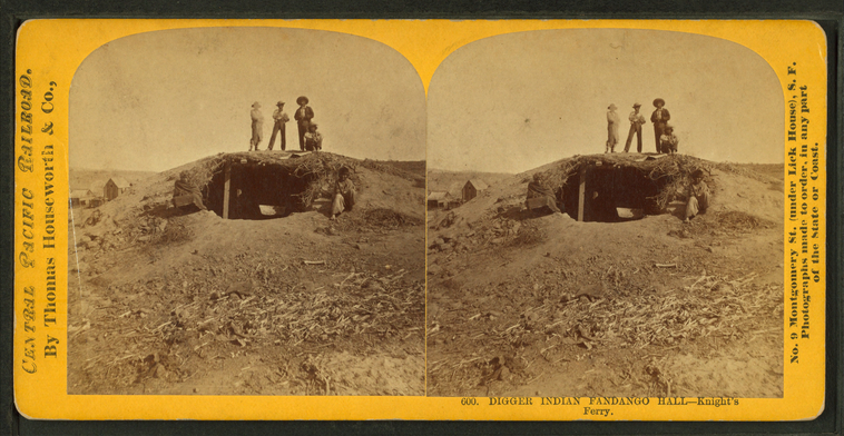
Digger Indian fandango hall, Knight's Ferry.
Publisher: Houseworth, Thomas & Co.
Subjects: California, Washo Indians
Collection: NYPL Digital Collections: Robert N. Dennis [From The New York Public Library]
Subjects: California, Washo Indians
Collection: NYPL Digital Collections: Robert N. Dennis [From The New York Public Library]
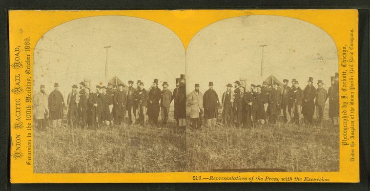
Representatives of the press with the excursion.
Publisher: Carbutt, John
Photographer: Carbutt, John (1832-1905)
Subjects: Nebraska, Journalists
Collection: NYPL Digital Collections: Robert N. Dennis [From The New York Public Library]
Photographer: Carbutt, John (1832-1905)
Subjects: Nebraska, Journalists
Collection: NYPL Digital Collections: Robert N. Dennis [From The New York Public Library]
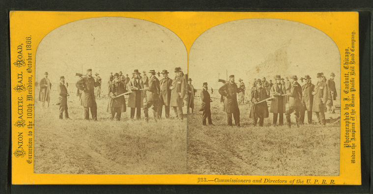
Commissioners and directors of the U.P.R.R.
Publisher: Carbutt, John
Photographer: Carbutt, John (1832-1905)
Subjects: Nebraska, Capitalists & financiers, Directors of corporations
Collection: NYPL Digital Collections: Robert N. Dennis [From The New York Public Library]
Photographer: Carbutt, John (1832-1905)
Subjects: Nebraska, Capitalists & financiers, Directors of corporations
Collection: NYPL Digital Collections: Robert N. Dennis [From The New York Public Library]
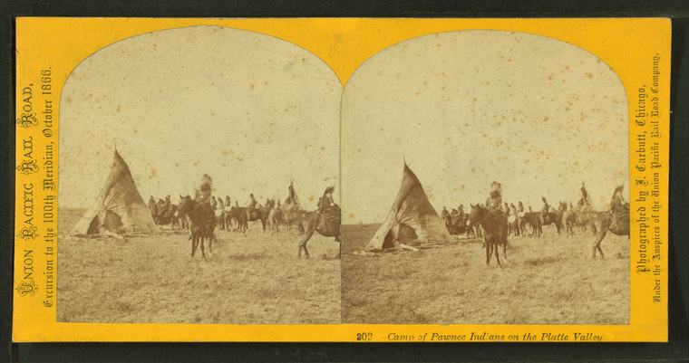
Camp of Pawnee Indians on the Platte Valley.
Publisher: Carbutt, John
Photographer: Carbutt, John (1832-1905)
Subjects: Nebraska, Pawnee Indians, Indians of North America, Dwellings
Collection: NYPL Digital Collections: Robert N. Dennis [From The New York Public Library]
Photographer: Carbutt, John (1832-1905)
Subjects: Nebraska, Pawnee Indians, Indians of North America, Dwellings
Collection: NYPL Digital Collections: Robert N. Dennis [From The New York Public Library]
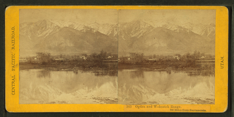
Ogden and Wahsatch Range, 742 miles from Sacramento.
Publisher: Hart, Alfred A.
Photographer: Hart, Alfred A. (1816-1908)
Subjects: Sierra Nevada (Calif. and Nev.), Mountains, Snow, Lakes & ponds
Collection: NYPL Digital Collections: Robert N. Dennis [From The New York Public Library]
Photographer: Hart, Alfred A. (1816-1908)
Subjects: Sierra Nevada (Calif. and Nev.), Mountains, Snow, Lakes & ponds
Collection: NYPL Digital Collections: Robert N. Dennis [From The New York Public Library]
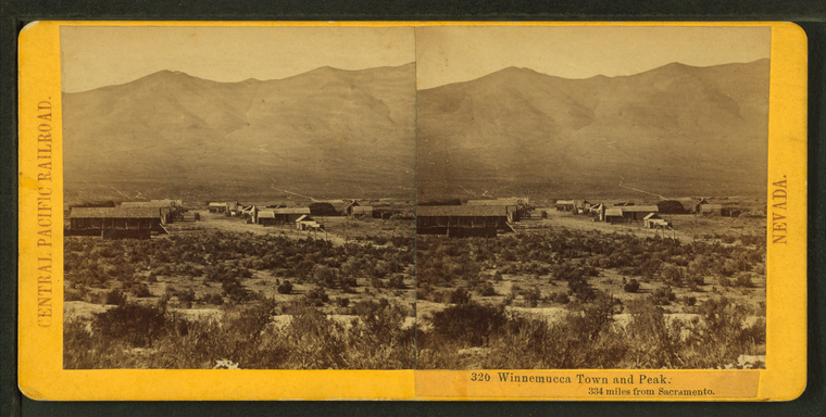
Winnemucca town and peak, 334 miles from Sacramentto.
Publisher: Hart, Alfred A.
Photographer: Hart, Alfred A. (1816-1908)
Subjects: Sierra Nevada (Calif. and Nev.), Mountains, Cities & towns
Collection: NYPL Digital Collections: Robert N. Dennis [From The New York Public Library]
Photographer: Hart, Alfred A. (1816-1908)
Subjects: Sierra Nevada (Calif. and Nev.), Mountains, Cities & towns
Collection: NYPL Digital Collections: Robert N. Dennis [From The New York Public Library]
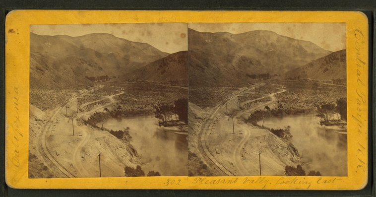
Pleasant Valley, looking East.
Publisher: Hart, Alfred A.
Photographer: Hart, Alfred A. (1816-1908)
Subjects: Sierra Nevada (Calif. and Nev.), Canyons, Valleys, Railroad tracks, Truckee River (Calif. and Nev.)
Collection: NYPL Digital Collections: Robert N. Dennis [From The New York Public Library]
Photographer: Hart, Alfred A. (1816-1908)
Subjects: Sierra Nevada (Calif. and Nev.), Canyons, Valleys, Railroad tracks, Truckee River (Calif. and Nev.)
Collection: NYPL Digital Collections: Robert N. Dennis [From The New York Public Library]
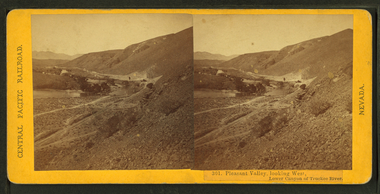
Pleasant Valley, looking West, Lower Canyon of Truckee River.
Publisher: Hart, Alfred A.
Photographer: Hart, Alfred A. (1816-1908)
Subjects: Sierra Nevada (Calif. and Nev.), Canyons, Valleys, Railroad tracks, Truckee River (Calif. and Nev.)
Collection: NYPL Digital Collections: Robert N. Dennis [From The New York Public Library]
Photographer: Hart, Alfred A. (1816-1908)
Subjects: Sierra Nevada (Calif. and Nev.), Canyons, Valleys, Railroad tracks, Truckee River (Calif. and Nev.)
Collection: NYPL Digital Collections: Robert N. Dennis [From The New York Public Library]
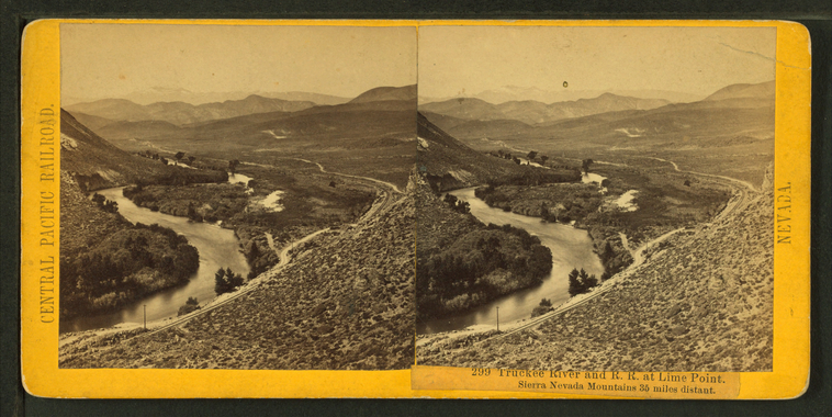
Truckee River and R.R. at Lime Point. Sierra Nevada Mountains, 35 miles distant.
Publisher: Hart, Alfred A.
Photographer: Hart, Alfred A. (1816-1908)
Subjects: Sierra Nevada (Calif. and Nev.), Canyons, Railroad tracks, Truckee River (Calif. and Nev.)
Collection: NYPL Digital Collections: Robert N. Dennis [From The New York Public Library]
Photographer: Hart, Alfred A. (1816-1908)
Subjects: Sierra Nevada (Calif. and Nev.), Canyons, Railroad tracks, Truckee River (Calif. and Nev.)
Collection: NYPL Digital Collections: Robert N. Dennis [From The New York Public Library]
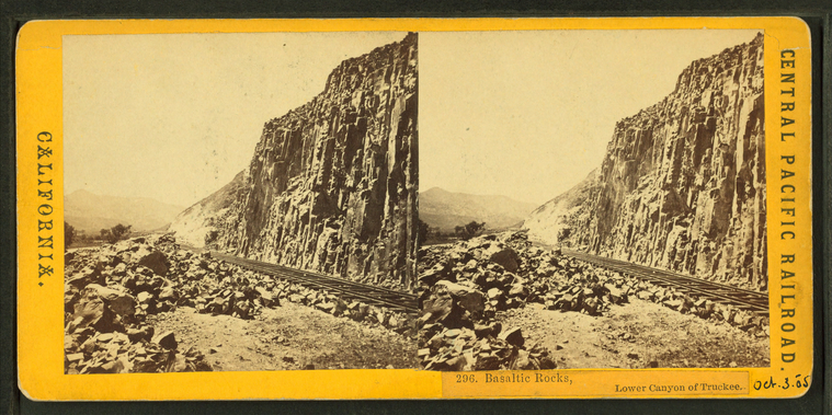
Basaltic Rocks, Lower Canyon of the Truckee.
Publisher: Hart, Alfred A.
Photographer: Hart, Alfred A. (1816-1908)
Subjects: Sierra Nevada (Calif. and Nev.), Canyons, Railroad tracks, Volcanic rock
Collection: NYPL Digital Collections: Robert N. Dennis [From The New York Public Library]
Photographer: Hart, Alfred A. (1816-1908)
Subjects: Sierra Nevada (Calif. and Nev.), Canyons, Railroad tracks, Volcanic rock
Collection: NYPL Digital Collections: Robert N. Dennis [From The New York Public Library]
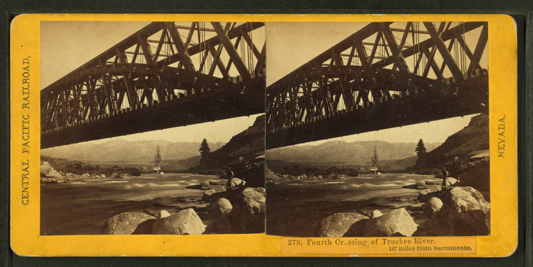
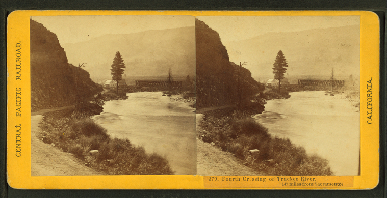
Fourth Crossing of the Truckee River. 147 miles from Sacramento.
Publisher: Hart, Alfred A.
Photographer: Hart, Alfred A. (1816-1908)
Subjects: Sierra Nevada (Calif. and Nev.), Rock formations, Railroad bridges, Truckee River (Calif. and Nev.)
Collection: NYPL Digital Collections: Robert N. Dennis [From The New York Public Library]
Photographer: Hart, Alfred A. (1816-1908)
Subjects: Sierra Nevada (Calif. and Nev.), Rock formations, Railroad bridges, Truckee River (Calif. and Nev.)
Collection: NYPL Digital Collections: Robert N. Dennis [From The New York Public Library]
Fourth Crossing of the Truckee River. 147 miles from Sacramento.
Publisher: Hart, Alfred A.
Photographer: Hart, Alfred A. (1816-1908)
Subjects: Sierra Nevada (Calif. and Nev.), Railroad bridges, Truckee River (Calif. and Nev.)
Collection: NYPL Digital Collections: Robert N. Dennis [From The New York Public Library]
Photographer: Hart, Alfred A. (1816-1908)
Subjects: Sierra Nevada (Calif. and Nev.), Railroad bridges, Truckee River (Calif. and Nev.)
Collection: NYPL Digital Collections: Robert N. Dennis [From The New York Public Library]
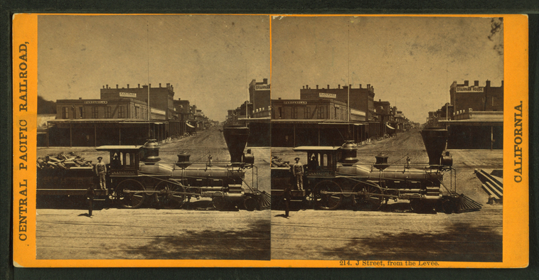
J Street from the levee.
Publisher: Hart, Alfred A.
Photographer: Hart, Alfred A. (1816-1908)
Subjects: Sierra Nevada (Calif. and Nev.), Railroad locomotives, Railroad employees
Collection: NYPL Digital Collections: Robert N. Dennis [From The New York Public Library]
Photographer: Hart, Alfred A. (1816-1908)
Subjects: Sierra Nevada (Calif. and Nev.), Railroad locomotives, Railroad employees
Collection: NYPL Digital Collections: Robert N. Dennis [From The New York Public Library]
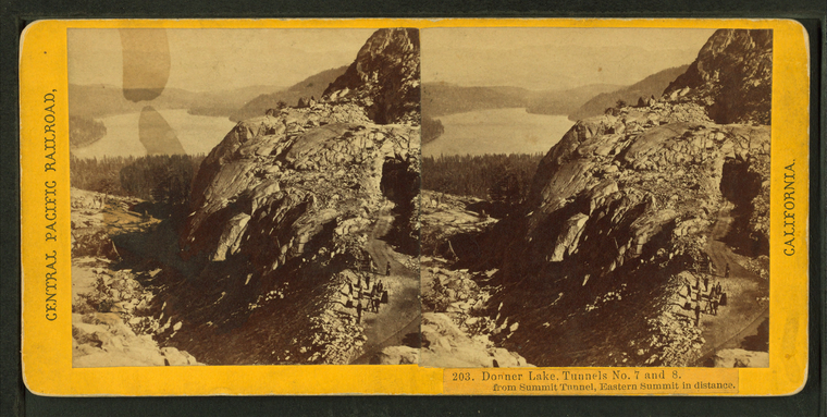
Donner Lake, Tunnels No. 7 and 8, from Summit Tunnel, Eastern Summit in distance.
Publisher: Hart, Alfred A.
Photographer: Hart, Alfred A. (1816-1908)
Subjects: Sierra Nevada (Calif. and Nev.), Lakes & ponds, Tunnels, Cliffs
Collection: NYPL Digital Collections: Robert N. Dennis [From The New York Public Library]
Photographer: Hart, Alfred A. (1816-1908)
Subjects: Sierra Nevada (Calif. and Nev.), Lakes & ponds, Tunnels, Cliffs
Collection: NYPL Digital Collections: Robert N. Dennis [From The New York Public Library]
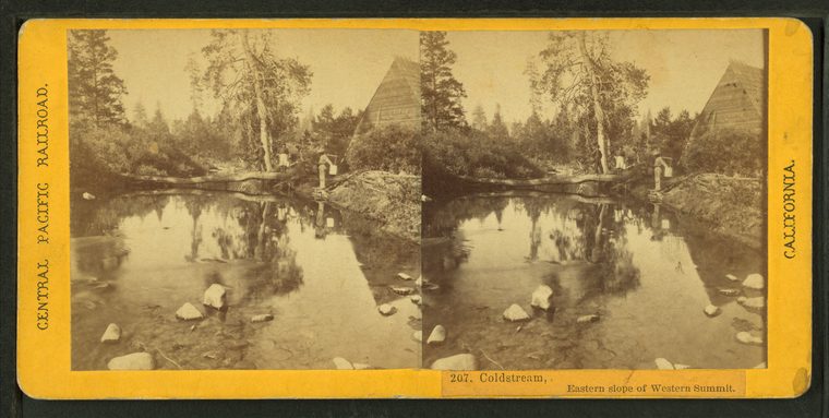
Coldstream, Eastern slope of Western Summit.
Publisher: Hart, Alfred A.
Photographer: Hart, Alfred A. (1816-1908)
Subjects: Sierra Nevada (Calif. and Nev.), Streams
Collection: NYPL Digital Collections: Robert N. Dennis [From The New York Public Library]
Photographer: Hart, Alfred A. (1816-1908)
Subjects: Sierra Nevada (Calif. and Nev.), Streams
Collection: NYPL Digital Collections: Robert N. Dennis [From The New York Public Library]
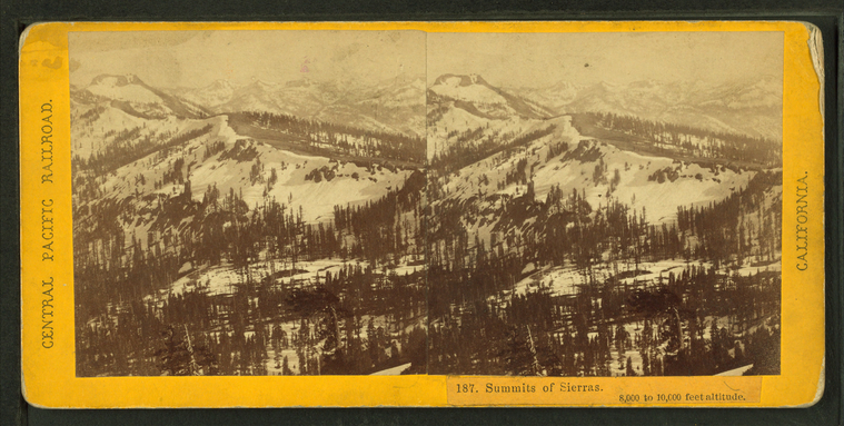
Summits of Sierras. 8,000 to 10,000 feet altitude.
Publisher: Hart, Alfred A.
Photographer: Hart, Alfred A. (1816-1908)
Subjects: Sierra Nevada (Calif. and Nev.), Mountains, Snow, Winter
Collection: NYPL Digital Collections: Robert N. Dennis [From The New York Public Library]
Photographer: Hart, Alfred A. (1816-1908)
Subjects: Sierra Nevada (Calif. and Nev.), Mountains, Snow, Winter
Collection: NYPL Digital Collections: Robert N. Dennis [From The New York Public Library]
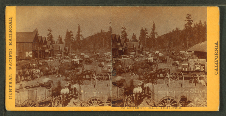
Main Street, Cisco, 5911 feet elevation.
Publisher: Hart, Alfred A.
Photographer: Hart, Alfred A. (1816-1908)
Subjects: Sierra Nevada (Calif. and Nev.), Carts & wagons, Horse teams
Collection: NYPL Digital Collections: Robert N. Dennis [From The New York Public Library]
Photographer: Hart, Alfred A. (1816-1908)
Subjects: Sierra Nevada (Calif. and Nev.), Carts & wagons, Horse teams
Collection: NYPL Digital Collections: Robert N. Dennis [From The New York Public Library]
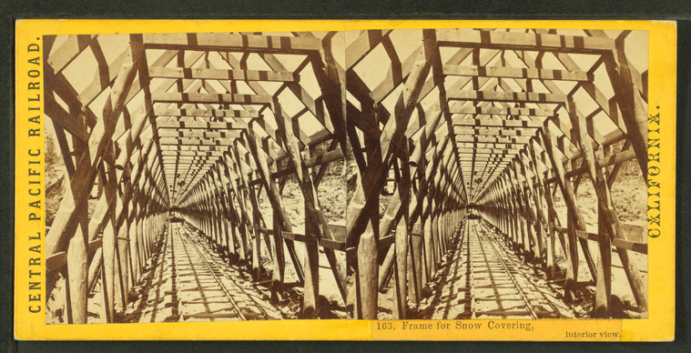
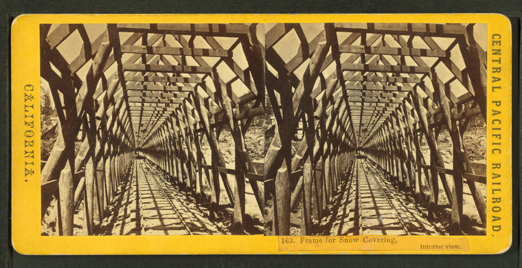
Frame for snow covering, interior view.
Publisher: Hart, Alfred A.
Photographer: Hart, Alfred A. (1816-1908)
Subjects: Sierra Nevada (Calif. and Nev.), Framing (Building), Snowsheds
Collection: NYPL Digital Collections: Robert N. Dennis [From The New York Public Library]
Photographer: Hart, Alfred A. (1816-1908)
Subjects: Sierra Nevada (Calif. and Nev.), Framing (Building), Snowsheds
Collection: NYPL Digital Collections: Robert N. Dennis [From The New York Public Library]
