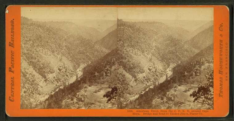
American River, from the C.P.R.R. around Cape Horn. Bridge and road to Yankee Jim's, Placer Co.
Publisher: Houseworth, Thomas & Co.
Subjects: California
Collection: NYPL Digital Collections: Robert N. Dennis [From The New York Public Library]
Subjects: California
Collection: NYPL Digital Collections: Robert N. Dennis [From The New York Public Library]
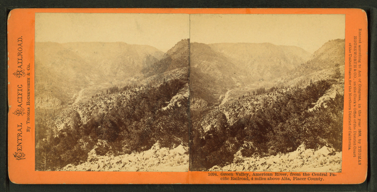
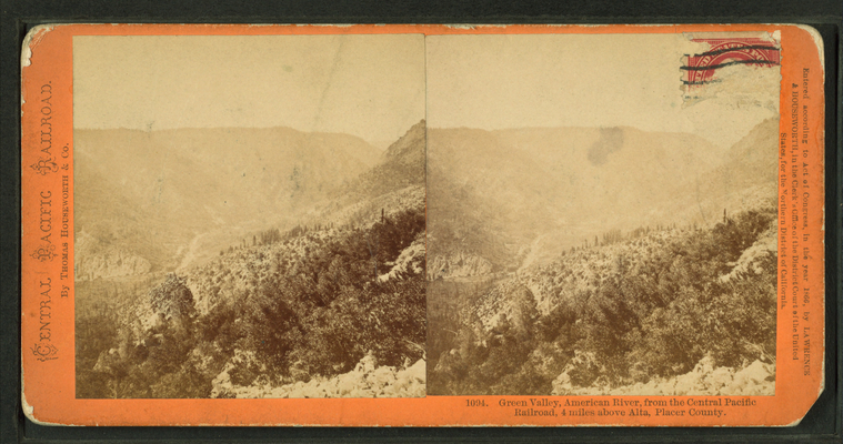
Green Valley, American River, from the Central Pacific Railroad, 4 miles above Alta, Placer County.
Publisher: Houseworth, Thomas & Co.
Subjects: California
Collection: NYPL Digital Collections: Robert N. Dennis [From The New York Public Library]
Subjects: California
Collection: NYPL Digital Collections: Robert N. Dennis [From The New York Public Library]
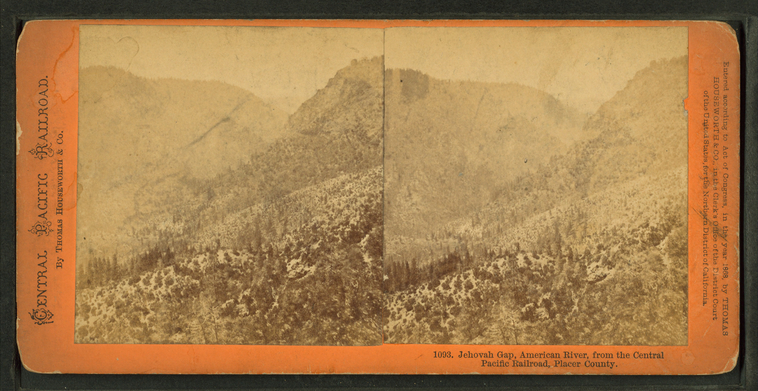
Jehovah Gap, American River, from the Central Pacific Railroad, Placer County.
Publisher: Houseworth, Thomas & Co.
Subjects: California
Collection: NYPL Digital Collections: Robert N. Dennis [From The New York Public Library]
Subjects: California
Collection: NYPL Digital Collections: Robert N. Dennis [From The New York Public Library]
Crystal Lake House, near Cisco, Central Pacific Railroad.
Publisher: Houseworth, Thomas & Co.
Subjects: California
Collection: NYPL Digital Collections: Robert N. Dennis [From The New York Public Library]
Subjects: California
Collection: NYPL Digital Collections: Robert N. Dennis [From The New York Public Library]
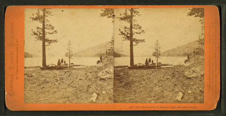
View from foot of Donner Lake, Nevada County.
Publisher: Houseworth, Thomas & Co.
Subjects: California
Collection: NYPL Digital Collections: Robert N. Dennis [From The New York Public Library]
Subjects: California
Collection: NYPL Digital Collections: Robert N. Dennis [From The New York Public Library]
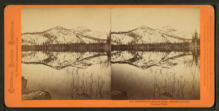
Reflection, Donner Lake, Mount Lincoln, Donner Park.
Publisher: Houseworth, Thomas & Co.
Subjects: California
Collection: NYPL Digital Collections: Robert N. Dennis [From The New York Public Library]
Subjects: California
Collection: NYPL Digital Collections: Robert N. Dennis [From The New York Public Library]
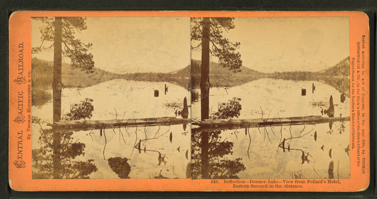
Reflection, Donner Lake, view from Pollard's Hotel, Eastern Summit in the distance.
Publisher: Houseworth, Thomas & Co.
Subjects: California
Collection: NYPL Digital Collections: Robert N. Dennis [From The New York Public Library]
Subjects: California
Collection: NYPL Digital Collections: Robert N. Dennis [From The New York Public Library]
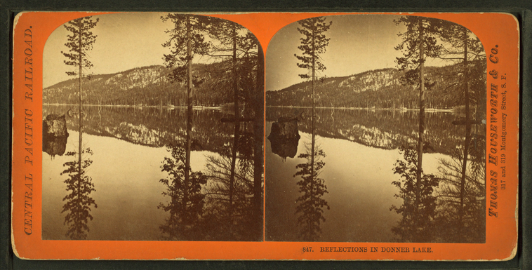
Reflections in Donner Lake.
Publisher: Houseworth, Thomas & Co.
Subjects: California
Collection: NYPL Digital Collections: Robert N. Dennis [From The New York Public Library]
Subjects: California
Collection: NYPL Digital Collections: Robert N. Dennis [From The New York Public Library]
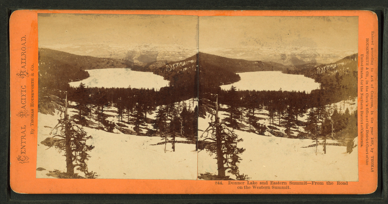
Donner Lake and Eastern Summit, from the road on the Western Summit.
Publisher: Houseworth, Thomas & Co.
Subjects: California
Collection: NYPL Digital Collections: Robert N. Dennis [From The New York Public Library]
Subjects: California
Collection: NYPL Digital Collections: Robert N. Dennis [From The New York Public Library]
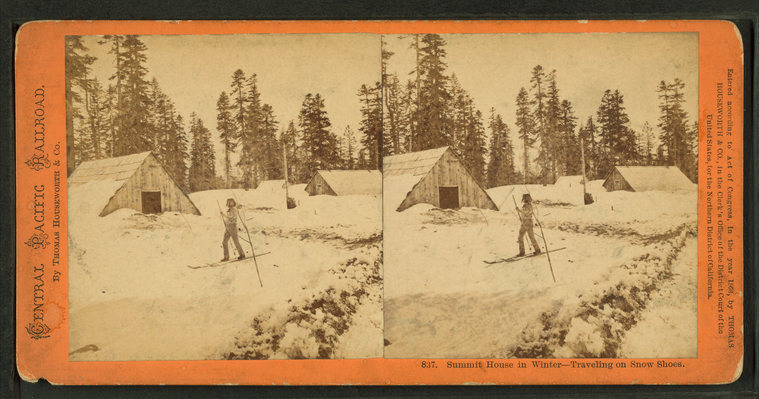
Summit House in winter, traveling on snow shoes.
Publisher: Houseworth, Thomas & Co.
Subjects: California
Collection: NYPL Digital Collections: Robert N. Dennis [From The New York Public Library]
Subjects: California
Collection: NYPL Digital Collections: Robert N. Dennis [From The New York Public Library]
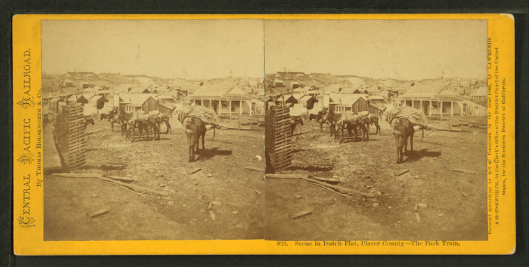
Scene in Dutch Flat, Placer County, the pack train.
Publisher: Houseworth, Thomas & Co.
Subjects: California, Packtrains
Collection: NYPL Digital Collections: Robert N. Dennis [From The New York Public Library]
Subjects: California, Packtrains
Collection: NYPL Digital Collections: Robert N. Dennis [From The New York Public Library]
Moonlight on the beach at Donner Lake.
Publisher: Houseworth, Thomas & Co.
Subjects: California
Collection: NYPL Digital Collections: Robert N. Dennis [From The New York Public Library]
Subjects: California
Collection: NYPL Digital Collections: Robert N. Dennis [From The New York Public Library]
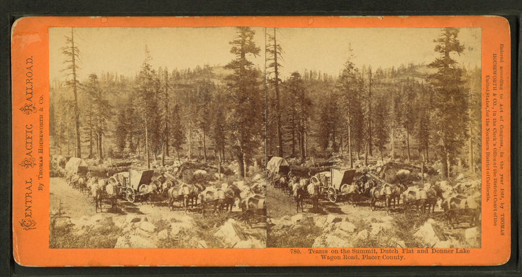
Teams on the summit, Dutch Flat and Donner Lake Wagon Road, Placer County.
Publisher: Houseworth, Thomas & Co.
Subjects: California
Collection: NYPL Digital Collections: Robert N. Dennis [From The New York Public Library]
Subjects: California
Collection: NYPL Digital Collections: Robert N. Dennis [From The New York Public Library]
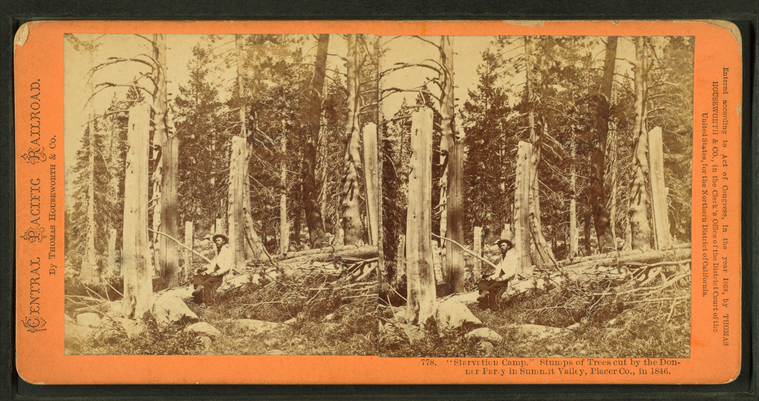
Starvation Camp." Stumps of trees cut by the Donner Party in Summit Valley, Placer Co., 1846.
Publisher: Houseworth, Thomas & Co.
Subjects: California, Donner Party
Collection: NYPL Digital Collections: Robert N. Dennis [From The New York Public Library]
Subjects: California, Donner Party
Collection: NYPL Digital Collections: Robert N. Dennis [From The New York Public Library]
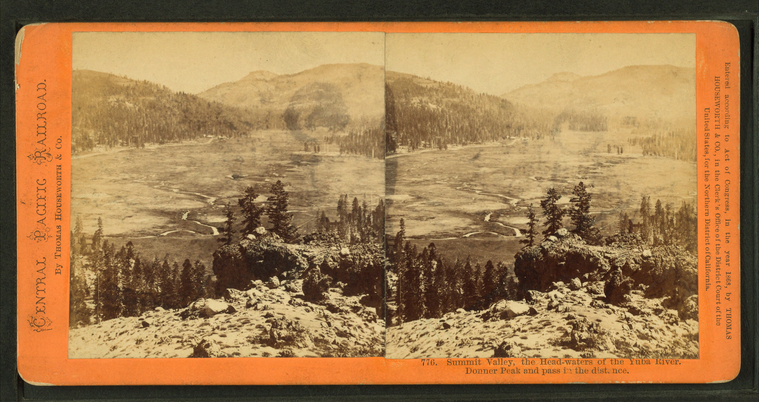
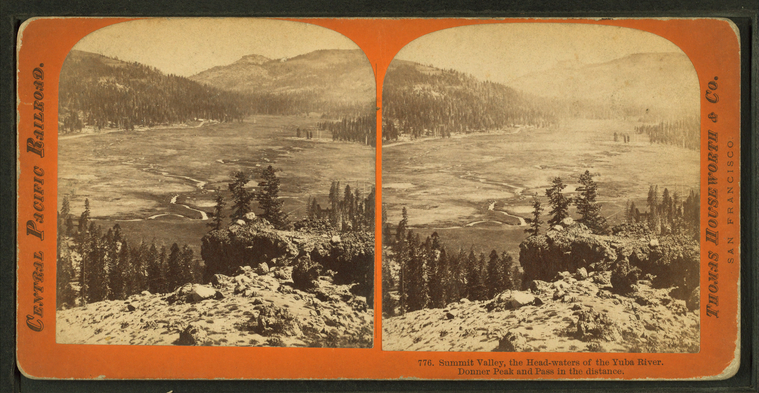
Summit Valley, the head-waters of the Yuba River. Donner Peak and Pass in the distance.
Publisher: Houseworth, Thomas & Co.
Subjects: California
Collection: NYPL Digital Collections: Robert N. Dennis [From The New York Public Library]
Subjects: California
Collection: NYPL Digital Collections: Robert N. Dennis [From The New York Public Library]
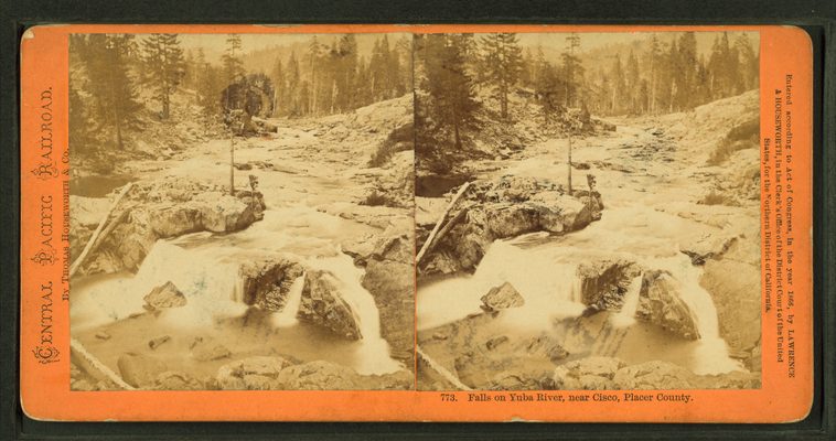
Falls on Yuba River, near Cisco, Placer County.
Publisher: Houseworth, Thomas & Co.
Subjects: California
Collection: NYPL Digital Collections: Robert N. Dennis [From The New York Public Library]
Subjects: California
Collection: NYPL Digital Collections: Robert N. Dennis [From The New York Public Library]
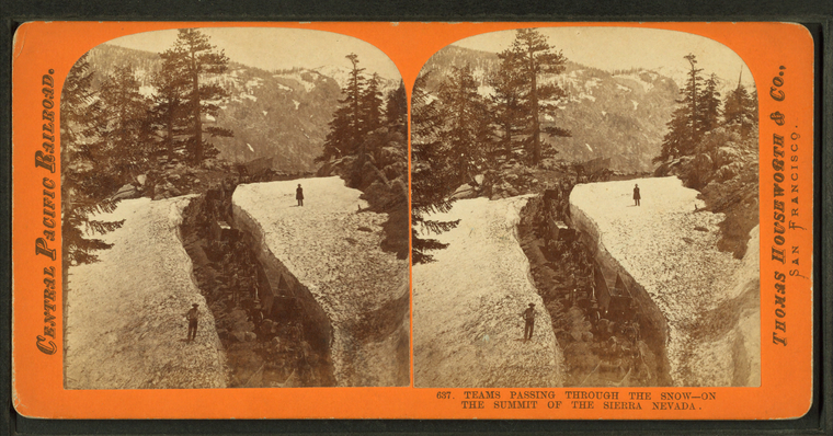
Teams passing through the snow, on the summit of the Sierra Nevada.
Publisher: Houseworth, Thomas & Co.
Subjects: California
Collection: NYPL Digital Collections: Robert N. Dennis [From The New York Public Library]
Subjects: California
Collection: NYPL Digital Collections: Robert N. Dennis [From The New York Public Library]
Group of Piute Indians.
Publisher: Houseworth, Thomas & Co.
Subjects: California, Paiute Indians
Collection: NYPL Digital Collections: Robert N. Dennis [From The New York Public Library]
Subjects: California, Paiute Indians
Collection: NYPL Digital Collections: Robert N. Dennis [From The New York Public Library]
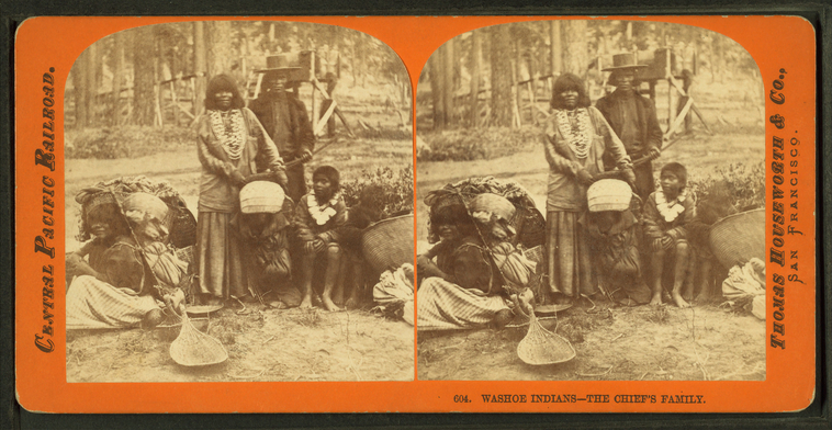
Washoe Indians, the chief's family.
Publisher: Houseworth, Thomas & Co.
Subjects: California, Washo Indians
Collection: NYPL Digital Collections: Robert N. Dennis [From The New York Public Library]
Subjects: California, Washo Indians
Collection: NYPL Digital Collections: Robert N. Dennis [From The New York Public Library]
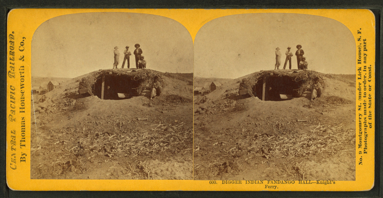
Digger Indian fandango hall, Knight's Ferry.
Publisher: Houseworth, Thomas & Co.
Subjects: California, Washo Indians
Collection: NYPL Digital Collections: Robert N. Dennis [From The New York Public Library]
Subjects: California, Washo Indians
Collection: NYPL Digital Collections: Robert N. Dennis [From The New York Public Library]
