South dome [of Washington Columns] from Glacier Point.
South dome [Washington Columns].
South dome [Washington Columns].
North and south dome [Washington Columns].
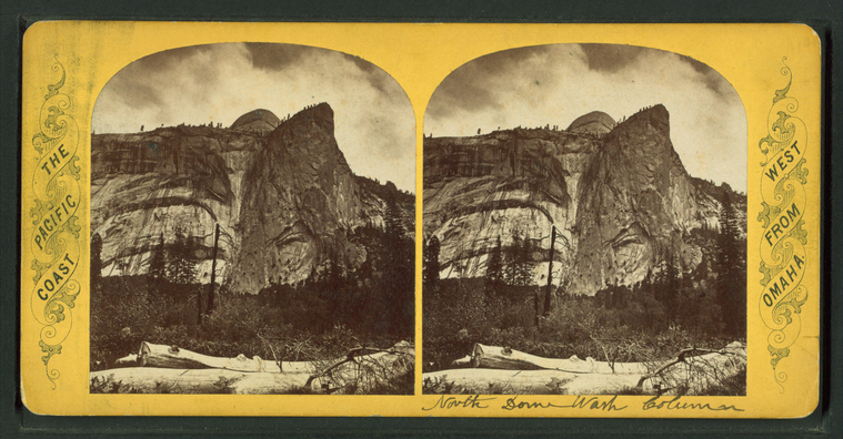
North dome of Washington Columns, distant view.
North dome of Washington Columns, near view.
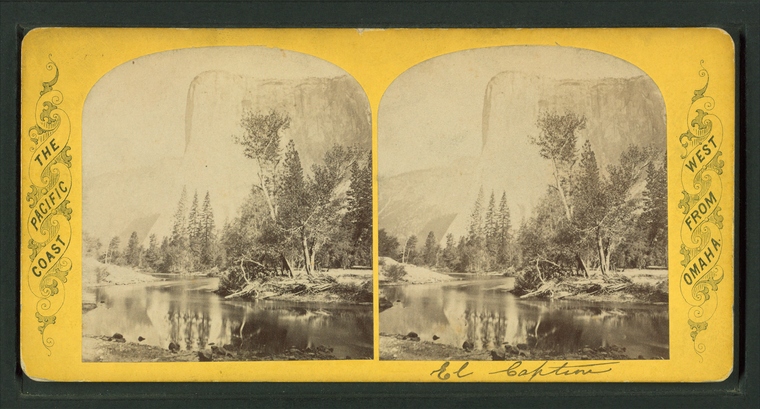
El Capitan
The Cap of Liberty [rock formation].
The Lost Arrow. [View of moutains and river valley.]
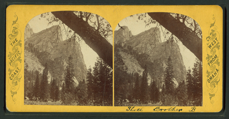
The Three Brothers B.
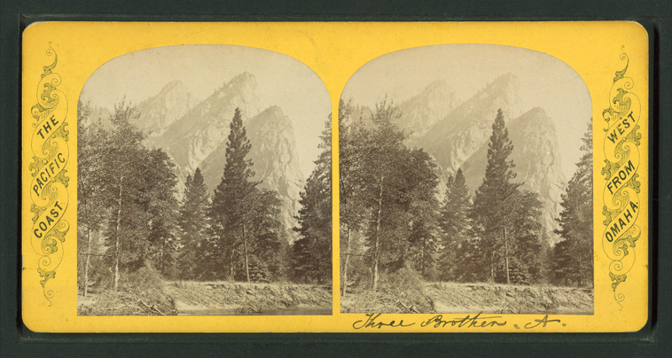
The Three Brothers A.
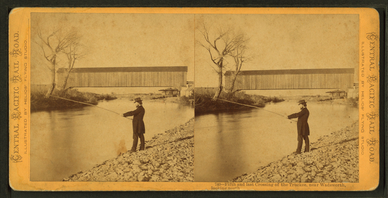
Fifth and last crossing of the Truckee, near Wadsworth, looking north.
Publisher: Bradley & Rulofson
Photographer: Muybridge, Eadweard (1830-1904)
Subjects: Men, Fishing, Truckee River (Calif. and Nev.)
Collection: NYPL Digital Collections: Robert N. Dennis [From The New York Public Library]
Photographer: Muybridge, Eadweard (1830-1904)
Subjects: Men, Fishing, Truckee River (Calif. and Nev.)
Collection: NYPL Digital Collections: Robert N. Dennis [From The New York Public Library]
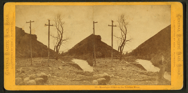
Moonlight effect on the Truckee River.
Publisher: Bradley & Rulofson
Photographer: Muybridge, Eadweard (1830-1904)
Subjects: Moonlight, Truckee River (Calif. and Nev.)
Collection: NYPL Digital Collections: Robert N. Dennis [From The New York Public Library]
Photographer: Muybridge, Eadweard (1830-1904)
Subjects: Moonlight, Truckee River (Calif. and Nev.)
Collection: NYPL Digital Collections: Robert N. Dennis [From The New York Public Library]
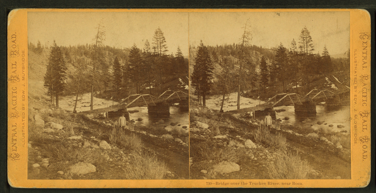
Bridge over the Truckee River, near Boca.
Publisher: Bradley & Rulofson
Photographer: Muybridge, Eadweard (1830-1904)
Subjects: Bridges, Truckee River (Calif. and Nev.)
Collection: NYPL Digital Collections: Robert N. Dennis [From The New York Public Library]
Photographer: Muybridge, Eadweard (1830-1904)
Subjects: Bridges, Truckee River (Calif. and Nev.)
Collection: NYPL Digital Collections: Robert N. Dennis [From The New York Public Library]
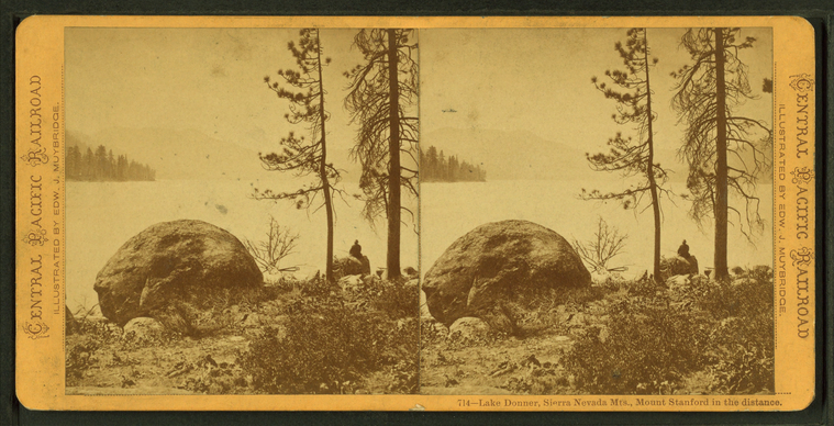
Lake Donner, Sierra Nevada Mts., Mount Stanford in the distance.
Publisher: Bradley & Rulofson
Photographer: Muybridge, Eadweard (1830-1904)
Subjects: California, Lakes & ponds, Sierra Nevada (Calif. and Nev.)
Collection: NYPL Digital Collections: Robert N. Dennis [From The New York Public Library]
Photographer: Muybridge, Eadweard (1830-1904)
Subjects: California, Lakes & ponds, Sierra Nevada (Calif. and Nev.)
Collection: NYPL Digital Collections: Robert N. Dennis [From The New York Public Library]
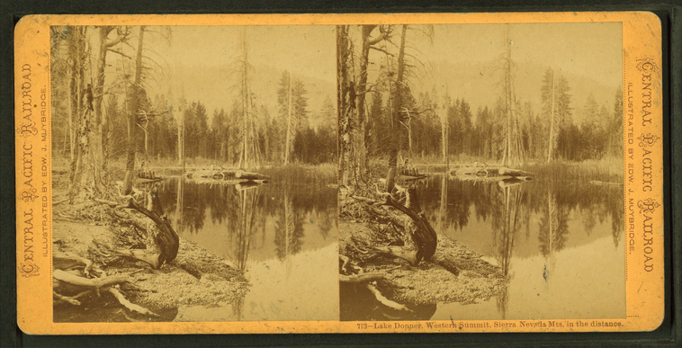
Lake Donner, Western Summit, Sierra Nevada Mts. in the distance.
Publisher: Bradley & Rulofson
Photographer: Muybridge, Eadweard (1830-1904)
Subjects: California, Lakes & ponds, Sierra Nevada (Calif. and Nev.)
Collection: NYPL Digital Collections: Robert N. Dennis [From The New York Public Library]
Photographer: Muybridge, Eadweard (1830-1904)
Subjects: California, Lakes & ponds, Sierra Nevada (Calif. and Nev.)
Collection: NYPL Digital Collections: Robert N. Dennis [From The New York Public Library]
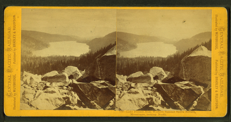
Lake Donner, from western summit Sierra Nevada Mountains, looking north.
Publisher: Bradley & Rulofson
Photographer: Muybridge, Eadweard (1830-1904)
Subjects: Sierra Nevada (Calif. and Nev.), Lakes & ponds, California, Mountains
Collection: NYPL Digital Collections: Robert N. Dennis [From The New York Public Library]
Photographer: Muybridge, Eadweard (1830-1904)
Subjects: Sierra Nevada (Calif. and Nev.), Lakes & ponds, California, Mountains
Collection: NYPL Digital Collections: Robert N. Dennis [From The New York Public Library]
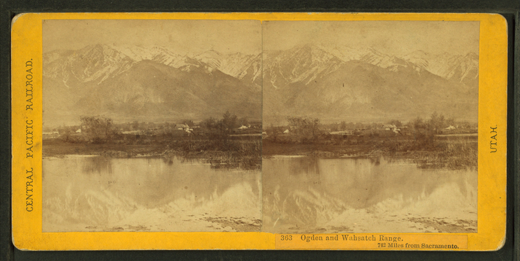
Ogden and Wahsatch Range, 742 miles from Sacramento.
Publisher: Hart, Alfred A.
Photographer: Hart, Alfred A. (1816-1908)
Subjects: Sierra Nevada (Calif. and Nev.), Mountains, Snow, Lakes & ponds
Collection: NYPL Digital Collections: Robert N. Dennis [From The New York Public Library]
Photographer: Hart, Alfred A. (1816-1908)
Subjects: Sierra Nevada (Calif. and Nev.), Mountains, Snow, Lakes & ponds
Collection: NYPL Digital Collections: Robert N. Dennis [From The New York Public Library]
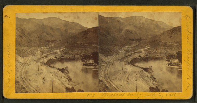
Pleasant Valley, looking East.
Publisher: Hart, Alfred A.
Photographer: Hart, Alfred A. (1816-1908)
Subjects: Sierra Nevada (Calif. and Nev.), Canyons, Valleys, Railroad tracks, Truckee River (Calif. and Nev.)
Collection: NYPL Digital Collections: Robert N. Dennis [From The New York Public Library]
Photographer: Hart, Alfred A. (1816-1908)
Subjects: Sierra Nevada (Calif. and Nev.), Canyons, Valleys, Railroad tracks, Truckee River (Calif. and Nev.)
Collection: NYPL Digital Collections: Robert N. Dennis [From The New York Public Library]
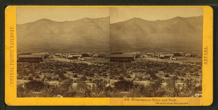
Winnemucca town and peak, 334 miles from Sacramentto.
Publisher: Hart, Alfred A.
Photographer: Hart, Alfred A. (1816-1908)
Subjects: Sierra Nevada (Calif. and Nev.), Mountains, Cities & towns
Collection: NYPL Digital Collections: Robert N. Dennis [From The New York Public Library]
Photographer: Hart, Alfred A. (1816-1908)
Subjects: Sierra Nevada (Calif. and Nev.), Mountains, Cities & towns
Collection: NYPL Digital Collections: Robert N. Dennis [From The New York Public Library]
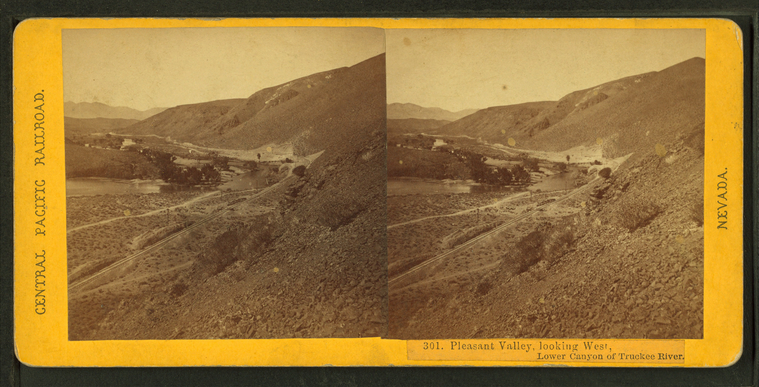
Pleasant Valley, looking West, Lower Canyon of Truckee River.
Publisher: Hart, Alfred A.
Photographer: Hart, Alfred A. (1816-1908)
Subjects: Sierra Nevada (Calif. and Nev.), Canyons, Valleys, Railroad tracks, Truckee River (Calif. and Nev.)
Collection: NYPL Digital Collections: Robert N. Dennis [From The New York Public Library]
Photographer: Hart, Alfred A. (1816-1908)
Subjects: Sierra Nevada (Calif. and Nev.), Canyons, Valleys, Railroad tracks, Truckee River (Calif. and Nev.)
Collection: NYPL Digital Collections: Robert N. Dennis [From The New York Public Library]
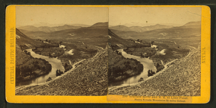
Truckee River and R.R. at Lime Point. Sierra Nevada Mountains, 35 miles distant.
Publisher: Hart, Alfred A.
Photographer: Hart, Alfred A. (1816-1908)
Subjects: Sierra Nevada (Calif. and Nev.), Canyons, Railroad tracks, Truckee River (Calif. and Nev.)
Collection: NYPL Digital Collections: Robert N. Dennis [From The New York Public Library]
Photographer: Hart, Alfred A. (1816-1908)
Subjects: Sierra Nevada (Calif. and Nev.), Canyons, Railroad tracks, Truckee River (Calif. and Nev.)
Collection: NYPL Digital Collections: Robert N. Dennis [From The New York Public Library]
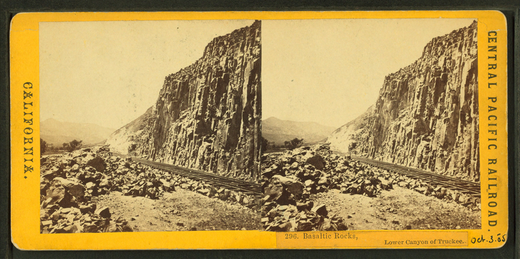
Basaltic Rocks, Lower Canyon of the Truckee.
Publisher: Hart, Alfred A.
Photographer: Hart, Alfred A. (1816-1908)
Subjects: Sierra Nevada (Calif. and Nev.), Canyons, Railroad tracks, Volcanic rock
Collection: NYPL Digital Collections: Robert N. Dennis [From The New York Public Library]
Photographer: Hart, Alfred A. (1816-1908)
Subjects: Sierra Nevada (Calif. and Nev.), Canyons, Railroad tracks, Volcanic rock
Collection: NYPL Digital Collections: Robert N. Dennis [From The New York Public Library]
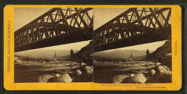
Fourth Crossing of the Truckee River. 147 miles from Sacramento.
Publisher: Hart, Alfred A.
Photographer: Hart, Alfred A. (1816-1908)
Subjects: Sierra Nevada (Calif. and Nev.), Rock formations, Railroad bridges, Truckee River (Calif. and Nev.)
Collection: NYPL Digital Collections: Robert N. Dennis [From The New York Public Library]
Photographer: Hart, Alfred A. (1816-1908)
Subjects: Sierra Nevada (Calif. and Nev.), Rock formations, Railroad bridges, Truckee River (Calif. and Nev.)
Collection: NYPL Digital Collections: Robert N. Dennis [From The New York Public Library]
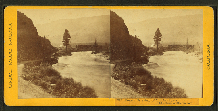
Fourth Crossing of the Truckee River. 147 miles from Sacramento.
Publisher: Hart, Alfred A.
Photographer: Hart, Alfred A. (1816-1908)
Subjects: Sierra Nevada (Calif. and Nev.), Railroad bridges, Truckee River (Calif. and Nev.)
Collection: NYPL Digital Collections: Robert N. Dennis [From The New York Public Library]
Photographer: Hart, Alfred A. (1816-1908)
Subjects: Sierra Nevada (Calif. and Nev.), Railroad bridges, Truckee River (Calif. and Nev.)
Collection: NYPL Digital Collections: Robert N. Dennis [From The New York Public Library]
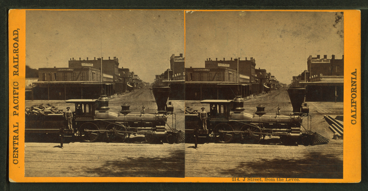
J Street from the levee.
Publisher: Hart, Alfred A.
Photographer: Hart, Alfred A. (1816-1908)
Subjects: Sierra Nevada (Calif. and Nev.), Railroad locomotives, Railroad employees
Collection: NYPL Digital Collections: Robert N. Dennis [From The New York Public Library]
Photographer: Hart, Alfred A. (1816-1908)
Subjects: Sierra Nevada (Calif. and Nev.), Railroad locomotives, Railroad employees
Collection: NYPL Digital Collections: Robert N. Dennis [From The New York Public Library]
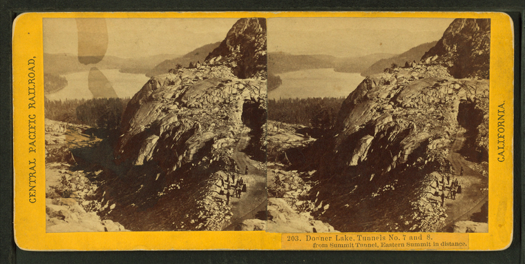
Donner Lake, Tunnels No. 7 and 8, from Summit Tunnel, Eastern Summit in distance.
Publisher: Hart, Alfred A.
Photographer: Hart, Alfred A. (1816-1908)
Subjects: Sierra Nevada (Calif. and Nev.), Lakes & ponds, Tunnels, Cliffs
Collection: NYPL Digital Collections: Robert N. Dennis [From The New York Public Library]
Photographer: Hart, Alfred A. (1816-1908)
Subjects: Sierra Nevada (Calif. and Nev.), Lakes & ponds, Tunnels, Cliffs
Collection: NYPL Digital Collections: Robert N. Dennis [From The New York Public Library]
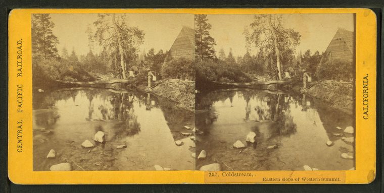
Coldstream, Eastern slope of Western Summit.
Publisher: Hart, Alfred A.
Photographer: Hart, Alfred A. (1816-1908)
Subjects: Sierra Nevada (Calif. and Nev.), Streams
Collection: NYPL Digital Collections: Robert N. Dennis [From The New York Public Library]
Photographer: Hart, Alfred A. (1816-1908)
Subjects: Sierra Nevada (Calif. and Nev.), Streams
Collection: NYPL Digital Collections: Robert N. Dennis [From The New York Public Library]
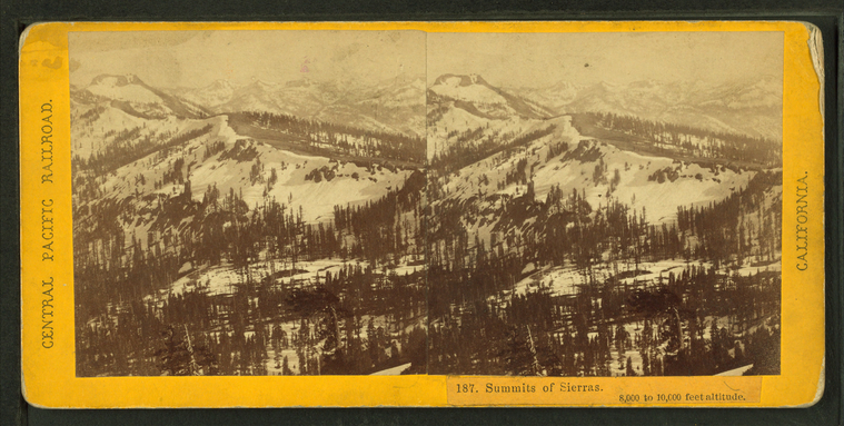
Summits of Sierras. 8,000 to 10,000 feet altitude.
Publisher: Hart, Alfred A.
Photographer: Hart, Alfred A. (1816-1908)
Subjects: Sierra Nevada (Calif. and Nev.), Mountains, Snow, Winter
Collection: NYPL Digital Collections: Robert N. Dennis [From The New York Public Library]
Photographer: Hart, Alfred A. (1816-1908)
Subjects: Sierra Nevada (Calif. and Nev.), Mountains, Snow, Winter
Collection: NYPL Digital Collections: Robert N. Dennis [From The New York Public Library]
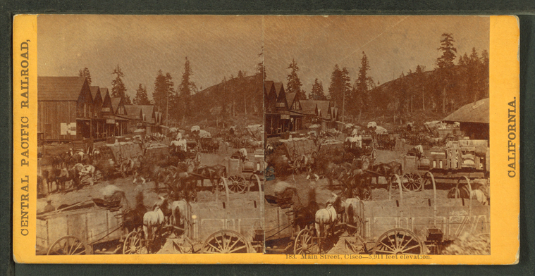
Main Street, Cisco, 5911 feet elevation.
Publisher: Hart, Alfred A.
Photographer: Hart, Alfred A. (1816-1908)
Subjects: Sierra Nevada (Calif. and Nev.), Carts & wagons, Horse teams
Collection: NYPL Digital Collections: Robert N. Dennis [From The New York Public Library]
Photographer: Hart, Alfred A. (1816-1908)
Subjects: Sierra Nevada (Calif. and Nev.), Carts & wagons, Horse teams
Collection: NYPL Digital Collections: Robert N. Dennis [From The New York Public Library]
![South dome [of Washington Columns] from Glacier Point. Stereoview Card](http://images.nypl.org/index.php?id=G89F393_011F&t=w&download=1&suffix=510d47e0-3f21-a3d9-e040-e00a18064a99.001)
![South dome [Washington Columns]. Stereoview Card](http://images.nypl.org/index.php?id=G89F393_010F&t=w&download=1&suffix=510d47e0-3f1f-a3d9-e040-e00a18064a99.001)
![South dome [Washington Columns]. Stereoview Card](http://images.nypl.org/index.php?id=G89F393_009F&t=w&download=1&suffix=510d47e0-3f1d-a3d9-e040-e00a18064a99.001)
![North and south dome [Washington Columns]. Stereoview Card](http://images.nypl.org/index.php?id=G89F393_008F&t=w&download=1&suffix=510d47e0-3f1b-a3d9-e040-e00a18064a99.001)

![The Cap of Liberty [rock formation]. Stereoview Card](http://images.nypl.org/index.php?id=G89F393_004F&t=w&download=1&suffix=510d47e0-3f13-a3d9-e040-e00a18064a99.001)
![The Lost Arrow. [View of moutains and river valley.] Stereoview Card](http://images.nypl.org/index.php?id=G89F393_003F&t=w&download=1&suffix=510d47e0-3f11-a3d9-e040-e00a18064a99.001)
